I followed a hardly trafficked road that ran alongside a freeway, constantly passing underneath overpasses and wondering to myself what I would do if a bear was just chilling around the next bend. The landscape was bleak, rock dirt and stifled, dry grass. There were a bunch of campgrounds concentrated around a reservoir called Clark’s Canyon, so as I neared the end of my planned mileage, we paused to look at our options. The wind had been fighting me most of the day so far, and up above this reservoir they were fierce. We chose a campsite and put up our tent, struggling just to keep it from flying away. My temper was short. I was hungry and exhausted and scared to lose our shelter. The ground was so hard that our stakes bent when we drove them in the ground. We did manage to get the tent up and filled it with our suitcases and camp chairs so it wouldn’t fly away the moment we looked away. The wind blew so hard the tent was flat on the ground more than it was upright.
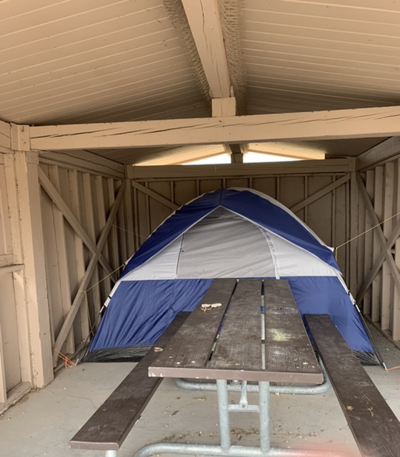
Our campground had picnic shelters at each site, so I decided we’d move the tent inside of the shelter to shield it from the rain. The ground was so hard it was difficult to pull the stakes out, but we wriggled the tent in the shelter and I used paracord to tie it down. It worked out well, though the picnic table was chained to the ground, so we had some trouble getting in and out of the tent door.
With that achieved, I went back to the road to finish my mileage. My mom stayed behind for a bit to try to join a zoom call she has every Tuesday. The wind was fighting me as she passed me, and shortly after it started to rain. Not just rain, but freezing rain that jettisoned toward me with the force of that intense wind. I was being pelted, and despite the fact that I was going down a mountainside, the wind was so strong I was barely moving forward. And of course I left my GPS tracker in the car, so I couldn’t sent out a distress signal. I thought my mom was psychic when I saw her heading towards me. She came back to ask me if I wanted my raincoat and I told her “I’m not doing this” Loaded my bike on her car and headed back to the campground after only a mile or two. The rain calmed, my mom and I played card games, made dinner, read Dracula and went to bed. It was supposed to rain that night and threatened to rain most of the next day. I didn’t want to bike up a mountain in the rain. We heard the thrashing wind all night and were both sore the next morning from sleeping on concrete (sleeping pads can only do so much). We waited til morning to make the call. It had rained and thundered so much in the night that the clouds had rung themselves dry. I didn’t have to delay anymore. I was going to bike the Continental Divide.

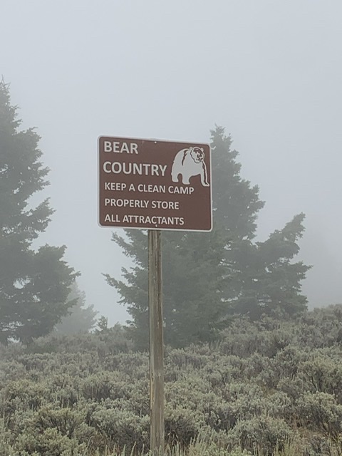
I biked through sparsely populated hills till I got to the gravel road, the Lemhi Pass. It warned me that this was a public road through private lands. I biked through cow pastures covered in sagebrush, stopping occasionally to carry my bike over cattle guards. I got up close and friendly with a number of cows just chilling in the road, and for a long while I had my music cranked up so I didn’t have to worry about sneaking up on bears. I gave up on the music. I could hardly hear anything over the sound of my tires on gravel. I had a bike bell on my bike so I attached it in a way that made it wring from the vibrations of the bike so I could make constant noise. There was a drastic change when I passed the final ranch. It went from stark, desert-like scenery to mountainsides covered in pine trees, roads overwhelmed by clusters of berry bushes. Places for bears to hide. The mountains were misty, or more likely smoky, and the higher I got the more the mist clung to the mountaintops and obscured what was ahead of me. I told my mom to meet me every five miles, not because I needed a break as much as I needed a few minutes where I didn’t worry about bears. As I neared the top there were fewer and fewer places for my mom to stop. I knew the peak was soon so I asked my mom to meet me in two and a half miles but she was nowhere to be found. I was shaking when I got to her, I was so tense. I couldn’t see what was around the next bend, I couldn’t see more than 10 feet in front of me!

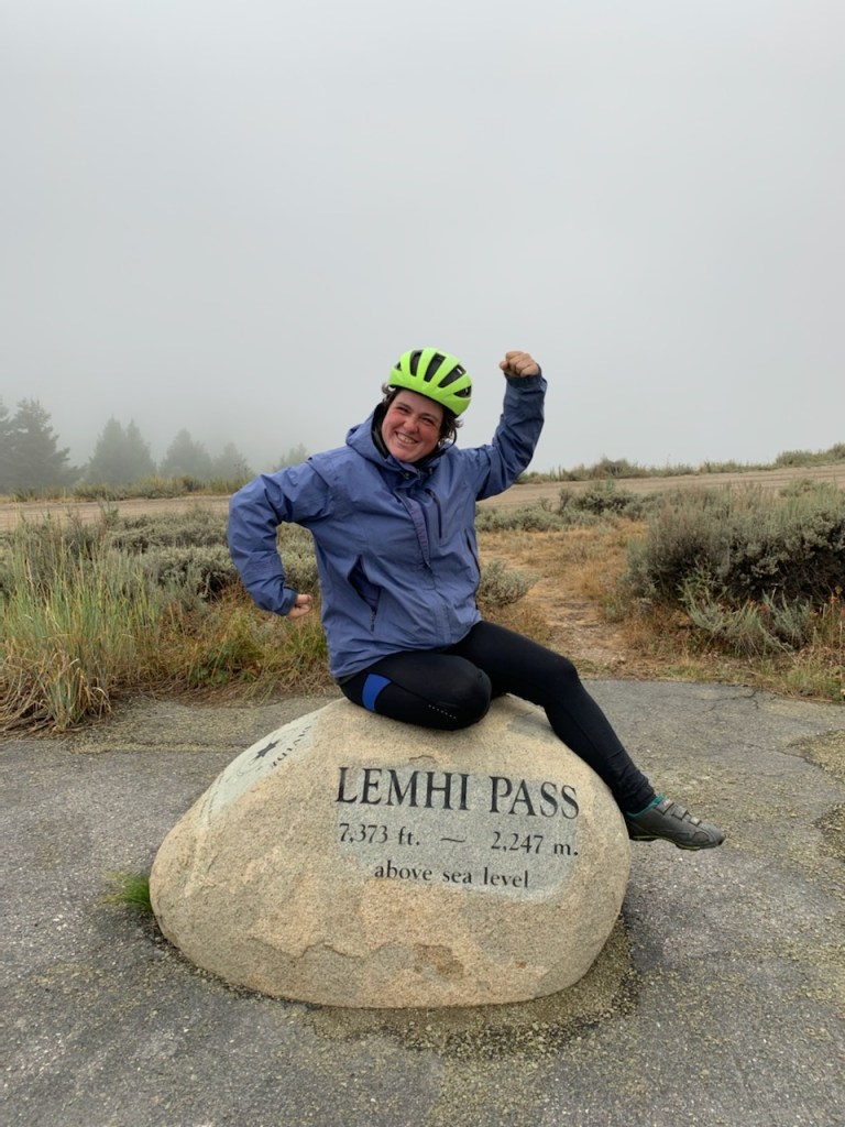
I made it to the top before I even realized what it was. It was near the intersection with the Continental Divide Trail. A road closure barricade blocked the road with signage that said it was closed for fire vehicle traffic. Just past that point there were dozens of army issue tents that I guessed were for the wildfire fighters. There was a huge fire not far from where we were. The mist I’d been experiencing had more than likely been exacerbated by the smoke. I left my bike by my mom’s car and walked up the road. I didn’t want to get all this way not to make it to the top of the pass, but not far from where I stopped there was a marker that marked the Lemhi Pass and the Continental Divide. I dragged my mom to it to take pictures, feeling a strong mixture of relief and disappointment. The best thing about going up mountains is getting to go down them after. I had made it to the top of this mountain, I did the hard part, but I didn’t get the reward of biking down the other side.
There was supposed to be a Sacagawea interpretive and picnic area not far away, so my mom and I snuck past the barrier to explore it, only to find dozens of army issue tents camped out. It seemed this is where the firefighters were sleeping. I took over the driving and got us down the windy gravel road, found another pass, again on an endless gravel road and drove us to the other side of the pass. I thought about stopping at the crest and biking down the other side, but the moment was passed and my mom and I were more concentrated on getting to Salmon, Idaho where we planned to stay the night.
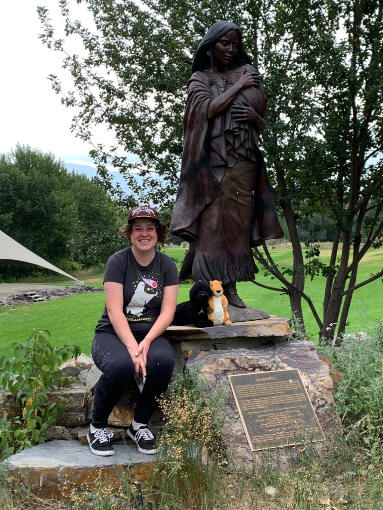
The next morning we backtracked to where I was supposed to pop out on the other side of the Lemhi Pass and I biked back to Salmon. I biked about half of my intended miles and took a break so we could visit the Sacagawea Interpretive Center where coincidentally they happened to have an interpreter named Judy giving a talk about Sacagawea. We stuck around and I met a kindred spirit who had become enamored with the Lewis and Clark Expedition the same way I had. She told us she was giving her favorite talk the next day, about highlights from the Journals and that we should come back if we were still in town. We back-tracked again, I finished biking to and past Salmon. My mom and I started looking for a campground closer to my end point. We stopped at the place I had suggested. In the tenting area there as a tent surrounded with a two-foot stack of railroad ties. I had heard of people doing this sort of thing to keep bears out, but this really freaked me out. Yes, bears are a big risk out here, but did this stranger who didn’t even seem to be there, know something we didn’t? Or did this camper do this because they planned to keep food in their tent or some other thing that might make bears more likely to harass this campground? I didn’t want to stay to find out.
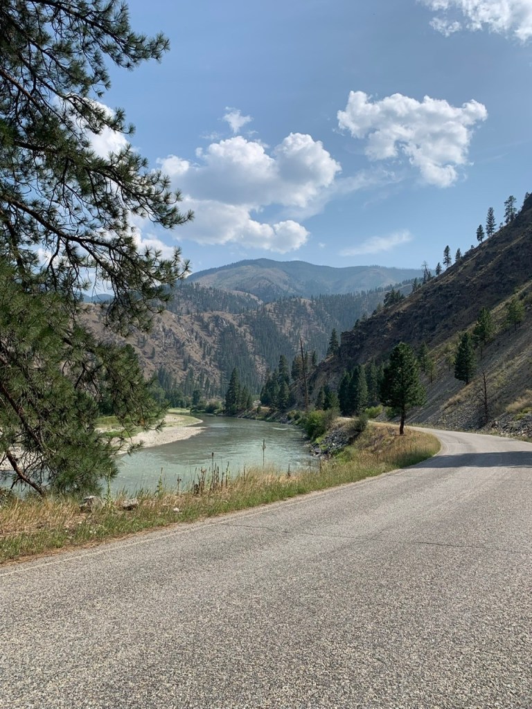
A Frustrated, we went back to Salmon and found a nice RV park that felt a whole lot safer. That’s where we chose to stay the night. The next morning I biked as far as a spur down one fork of the Salmon River that William Clark explored. We drove down it for a bit to take pictures before we went back to Salmon for the second Lewis and Clark talk. Judy talked about highlights from the journal, and like a true Lewis and Clark fangirl I got excited and could identify what story she was telling a few words in.
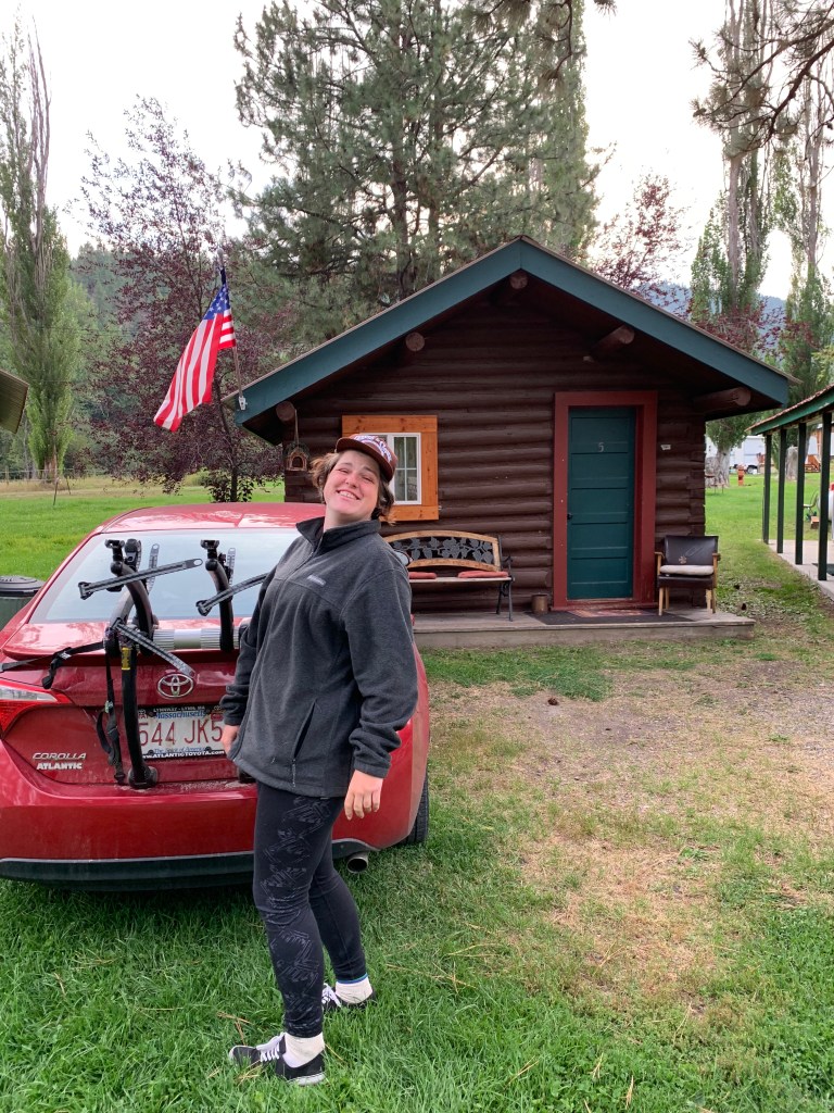
We returned the Salmon River and I kept going toward my next mountain pass. We stopped at a camping resort. There was both RV camping and tent camping, but we decided to check a small item off my bucket list and stayed in an inexpensive cabin. The campground had a Mexican restaurant that had next level carnitas and homemade tortilla chips. Of all the places! I’m pretty sure the family that owned these businesses were the entire population of the town.
It rained. No, it poured in the night, and it continued to pour all the next day. Generally I push through rain, but I knew I was doing a mountain pass. I was worried about visibility and my tires maintaining traction on the road, so as if we were stuck in Ground Hog Day, we headed back to Salmon to spend the day hopping around town. We went to the local museum. Local museums out west are often like exploring a well-organized attic. They always have vintage clothes and accessories, various collectable items. It seems as though when a family member dies and the family finds something they find interesting, they donate it to the museum. They’re always an eclectic blend of artifacts, and more often than not admission is by donation. The next day I’d biking another mountain pass.

This post is what I call a nail biter. I could NOT put it down. Well written. Well done. YIKES
LikeLike