Interpretive Plural.

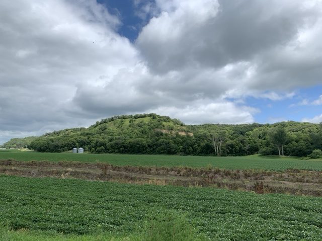
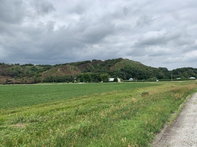
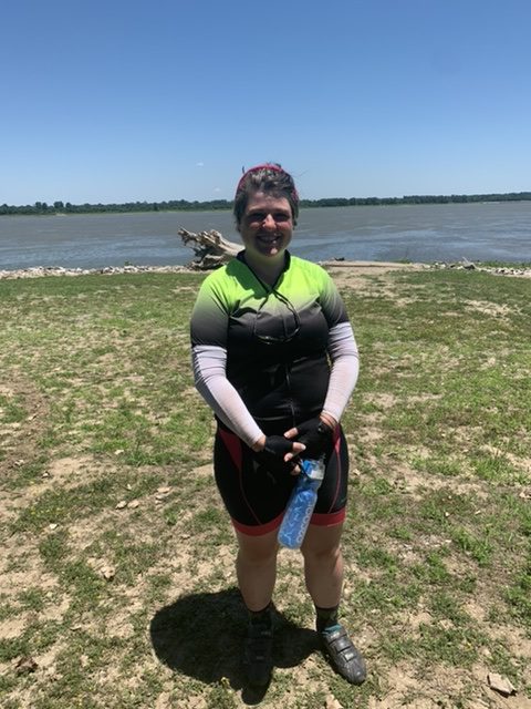
It’s not too far from Council Bluffs to Sioux City. My first day back on the road after so much rough travel, I got to Onawa. It was a long stretch of wonderful flatness, more what I’d been promised in the plains states than what I’d gotten. Seriously, glacial hills in Kansas? Loess Hills in the first part of Iowa! It was primarily a travel day, so as Lewis and Clark would write, I proceeded on.

In Council Bluffs I made a genius decision that has left me in a relative state of luxury ever since (my definition of luxury has become very different from a normal human’s. For instance, sleeping with a pillow has become luxury). I bought a thermos, one the size of a water bottle, the other 36 ounces. They can both hold ice water for 24 hours, loosely. Running out of water has been a pretty constant fear of mine, as one of my first nights on the trail I was at a campground with no working water. I wound up without enough to drink the next day because I needed water to cook my food and I needed to ration it. I have since acquired more water bottles just by purchasing water at gas stations. I’ve been teased about how many water bottles I carry (seven of various sizes) but I haven’t run out, and that’s the main thing.

The sunset view from my KOA campground in Onawa, IA

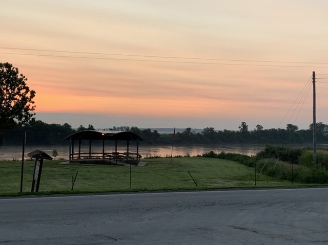
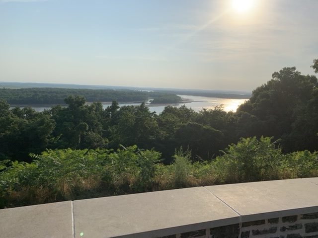
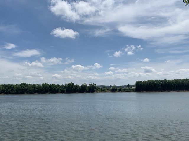
I may have jumped the gun a bit when I scheduled my campground that night. I saw there was a KOA near my route and reserved a site on Lake Lewis and Clark (beware, there are many Lake Lewis and Clarks on this trip. When I inevitably mention one again, it will be a different one in another state). This lake is an oxbow, which means it was at one time a bend in the Missouri, but it got cut off from the rest of the river by probably, time, erosion and drought, and now it’s a lake the shape of a horseshoe. I did have wifi at the KOA though, and a campsite right on the water, which is always a pleasure. I could see the Lewis and Clark State Park Visitor Center from my camp. I wanted to go there, but I’d already biked more than 70 miles. That was an activity for the morning.

This keelboat at the Lewis and Clark State Park was a bit shinier and less weather-worn than the one in Nebraska City. I really wanted to go up on the deck and to go inside the hold.

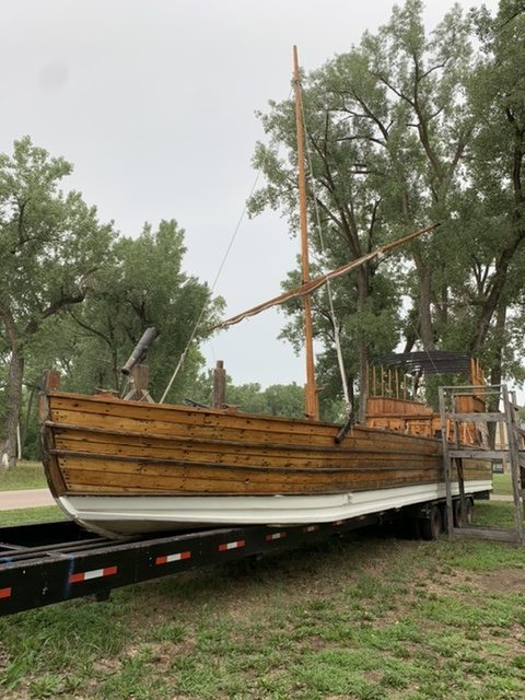
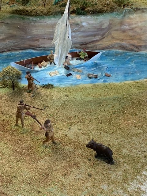
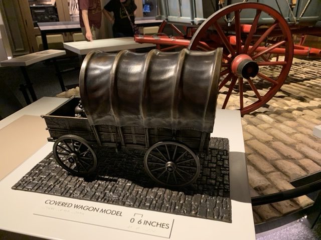
I stalled my departure the next morning just enough to get to the visitor center when it opened. It, like the Nebraska City Interpretive Center advertised a to scale replica of the keelboat. It turned out it had two! There was one on a trailer in the parking lot. I was a little disappointed that it was corded off and I couldn’t explore the deck. That said, I got a whole lot of pictures.

This prairie dog doesn’t count as my first sighting (at the Lewis and Clark Interpretive Center, Lewis and Clark State Park)

As I locked my bike up outside I was stopped by a couple who were curious about my trip, and we chatted for a while. This was the second time in a week I got to nerd out about Lewis and Clark to a history teacher. The man at the desk of the visitor center had a little dachshund named Speedy who was anything but, and he tried to walk right out the door when I came in. I asked if there was admission (there was not), and the man told me I had to ask a question when I finished looking at the exhibit.

Badger Badger Badger Badger…

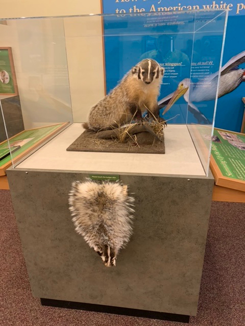
Inside there were a number of displays on the type of wildlife Lewis discovered, a little cot setup in a bifurcated keelboat (most definitely not to scale) to give an idea of the Captain’s Quarters, and the highlight, a display that taught you how to tie a few vital frontiersman knots (I regret very much that I am somehow incapable of remembering these techniques the minute I’m away from the instructions. I managed them correctly in the moment though). Finally, the highlight, there was a rope that went into a hole in a wall with a mural displaying the keelboat on the Missouri. When you pulled on the rope a little display would light up that said how quickly you were moving the keelboat with the force you were exerting. When I got there three children were “pulling” it and barely broke 1 mph. I pulled it and got it to 7mph on my own, but lord knows I couldn’t keep that up all day.

I imagine this keelboat is the same size as the one outside (though I was told they had to make the mast shorter to fit it in the building) but it looked huge indoors.

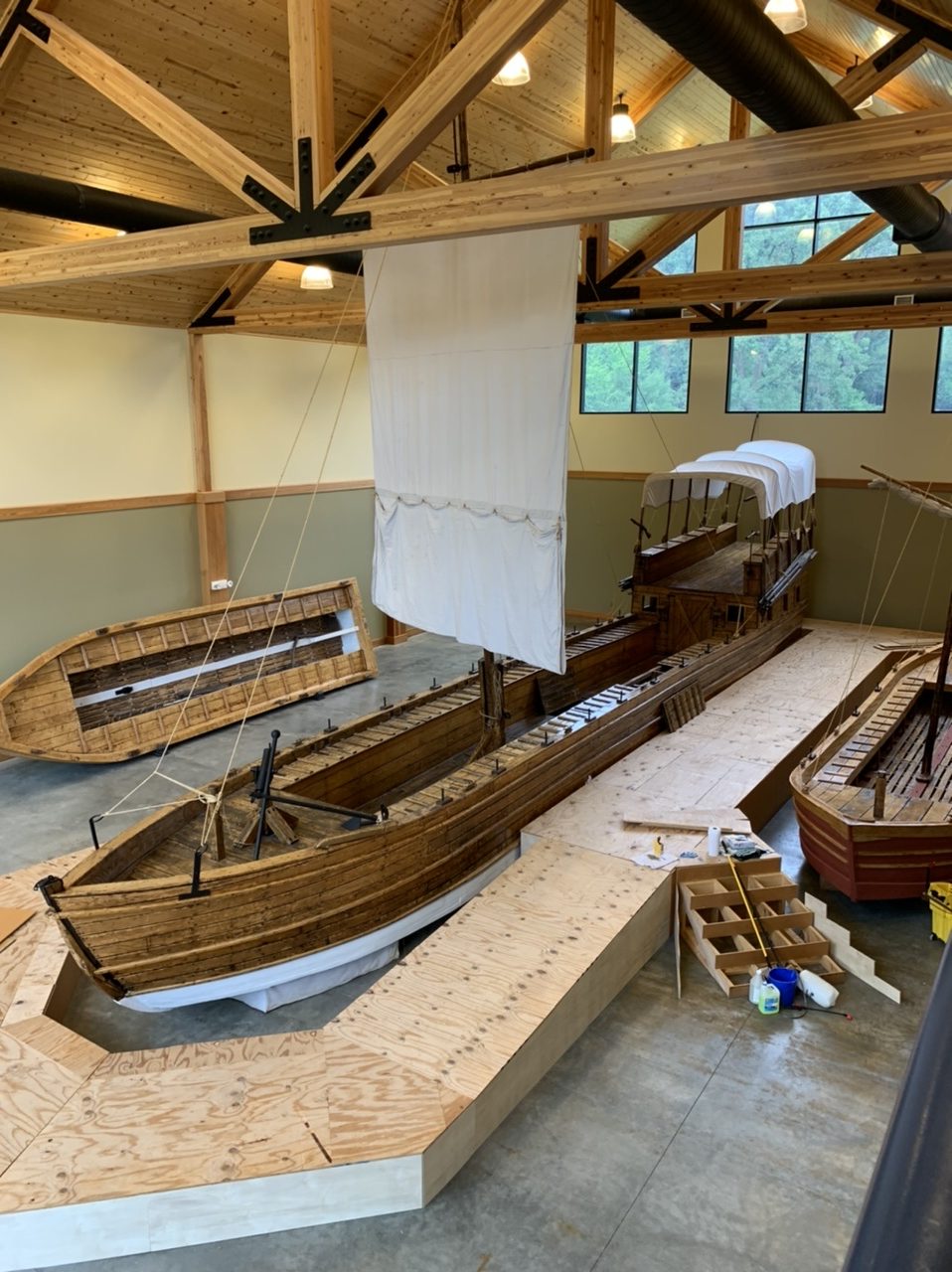
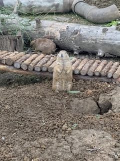
I went into the next enormous room, and I was standing above another keelboat, a pirogue and a model of the iron frame boat Lewis commissioned in Harpers Ferry, but this time covered in deerskin. The stairs were cordoned off again, but only because a carpenter was working downstairs, building a platform around the base of the boat, presumably to let visitors explore inside the keelboat. It was meant to rain again that afternoon, just as it had been drizzling the day before when I left Council Bluffs, so I decided to hunker down until the worst of it was over. I did hop outside to get my map though, and had to pay the toll. I’m at the point where it was tough to think of a question, just because I knew most of the information the museum sought to teach. Lewis and Clark has been my life for a while now. So, I asked about when I would finally see prairie dogs. I knew they were coming soon, but I was impatient for them. I knew they would be the boost in my morale that I’d been looking for. I wound up staying until about noon before heading out, watching the Ken Burns Documentary on the Expedition (I own it on Amazon Prime, but it was something to do). I got chills when they talked about how difficult the trip through the Rockies was. It was coming. I was going to have to brave it soon.

Sergeant Floyd Monument, Sioux City, IA

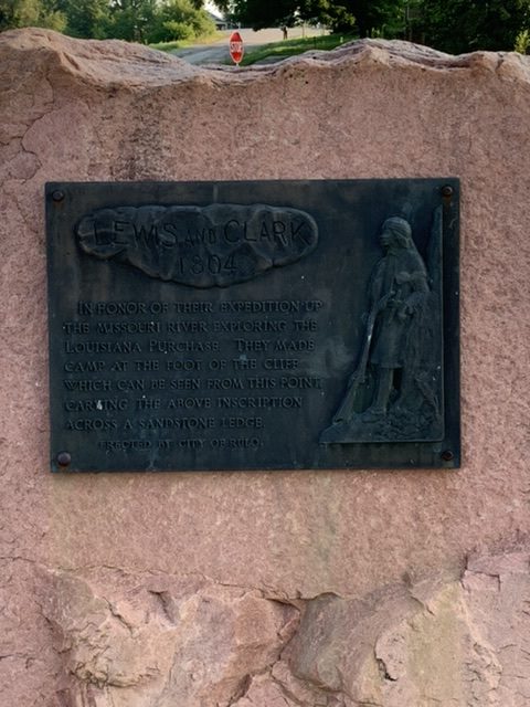
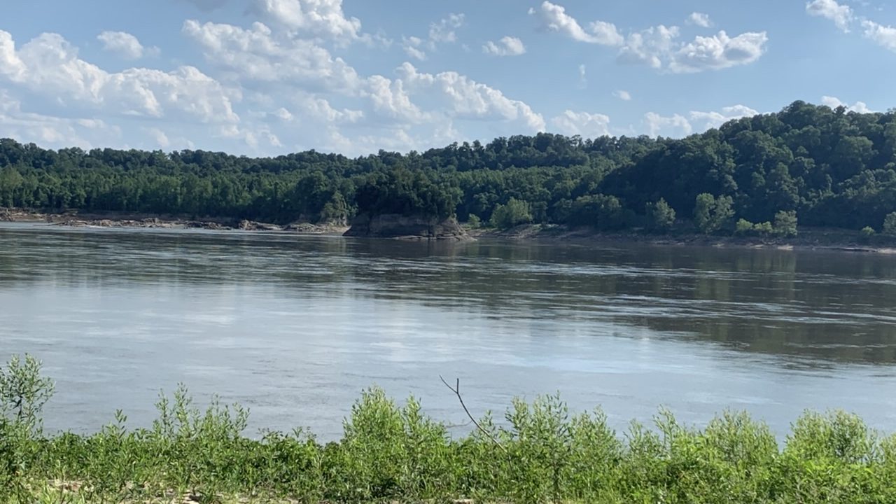
I trekked on to the southern edge of Sioux City and had a surprising amount of difficulty finding a hotel. That wound up being a theme. It rained again that night, and I was slow to get out of the city. There were a few tourist stops I was excited to see before I left, they opened later in the morning. First though, I went to Floyd’s Bluff. Charles Floyd was the only man on the entire expedition to die, and he died in what is now Sioux Falls, or rather, across the river from Sioux Falls. He was buried on a high bluff on the east side of the river, and Lewis and Clark named the bluff and nearby tributary after him. Those Loess Hills I’ve talked about are made up of an especially fine and fertile soil. They’re basically silt. If you’ve ever walked in a pond, a lake, or a riverbed and sunk into slime, that is what the hills are composed of, just not saturated with water. When they get saturated the land sloughs off and erodes into the river. That evidently happened to Floyd’s grave, so it was moved and eventually a stone obelisk was erected at the top of the bluff. I had thought about recording a video update for my blog at the monument, but when I got there the place had the peaceful serenity of a cemetery. I chose to wait.

I didn’t take pictures of the children in there regalia because that felt a little like exploiting children to me, but I was happy to take a picture of Rocky’s career goals.

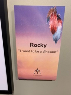
Next I stopped at the Lewis and Clark Interpretive Center. There were two buildings, one more about Iowa and the Missouri River. There was a display of photography by a South Dakotan Photographer, all images of the Missouri, many in winter conditions. There were photos of a group of Lakota children in there regalia with little plaques with quotes about what each child wanted to be when they grow up. It was adorable. Most want to be teachers. A few want to be Youtubers (good luck)! One little girl wants to be an archer. I firmly believe that child is a badass. But one little boy wants to be a dinosaur.

An illustration of “Eating Up the Lights” on the Missouri River.

The displays lead me down a hall with a history of the Missouri River, interesting facts about boat travel, information about flooding. I learned about the phrase “eat up the lights” and was fascinated. When Steamboats went up the Missouri, sometimes they couldn’t get to a port before dark, so the pilot would send out his most trusted men in a rowboat and they would float candles with paper around them to shield them from the wind. They’d weigh them down with string and rocks to keep them in place. The candles showed safe paths through the minefield of the Missouri (sandbars and imbedded logs were a constant terror) and the steamboat would head straight for the lights. As it neared it pushed the candles under and the lights would be extinguished.

I was thrilled by the barking animatronic Seaman. I didn’t even notice the prairie dog in the cage. I talked to one of the women who worked there and noticed it in the middle of our conversation.

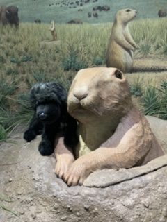
At the end of the hall I entered the Lewis and Clark section of the interpretive center. It was a completely different experience from any center I’d been to so far. It started with an animatronic Newfoundland, Seaman. If you pushed a button he moved and barked at a little prairie dog in a cage. There were stations after that where you picked up a little booklet. You got to choose who you were, either a named man on the expedition or a position like hunter or translator. Obviously I chose Meriwether Lewis. You put the first page of the booklet in and stamped it. As you went through the exhibits they each had a stamp station and you filled up your booklet by visiting each part of the exhibit in order.

Animatronic Thomas Jefferson, at the Lewis and Clark Interpretive Center in Sioux City, IA

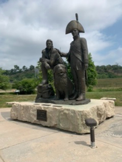
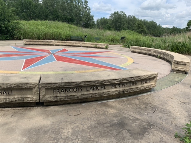
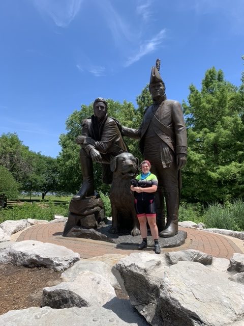
An animatronic Thomas Jefferson talked about the Louisiana Purchase and about Meriwether Lewis, another robotic Charles Floyd talked about himself and his death. Lewis and Clark had a conversation over Floyd’s grave. There was a section about a court martial that happened in the area, a section on Native American children’s games, and a 15-minute film of William Clark talking about his experiences on the expedition. Outside there was a garden with walking paths and statues of a number of different animals encountered on the trail. I got a good laugh because they had a Lewis and Clark (and Seaman) sculpture outside. It was the exact same sculpture I’d seen in Saint Charles, MO at the beginning of the Katy Trail, only smaller.

You can check out a picture of me in front of a larger version of this statue in Saint Charles, MO in a blog from a few weeks ago.

All Time Low

I crossed the river and set foot in Iowa for the first time, enjoying the slight change in scenery, very lush green bluffs, occasionally with a chunk missing that revealed a shock of red soil. There were technically towns on this ride, but the first few I passed through had been ravaged by a tornado recently enough that many of the houses had hardly been repaired. The first of these I came to, I followed a gravel road that google maps claimed would lead me to town. The gravel turned to dirt, and the dirt turned to a mound of dirt and nothing. Looking back, I think a bridge might have been taken out by the tornado.

Iowa Bluffs over farmland, the detour I had to take to get to the other side of the Levy. At least it was flat!

I had to backtrack a few miles and take a massive detour to get to the other side of the levy this road and bridge were meant to take me over. Then it was dirt roads for about twenty miles. If I hadn’t struggled enough already (gravel roads are not easy on a bike) cars were zooming past me and leaving me in an asphyxiating cloud of dust. When I saw them coming I would stop, pull over, and cover my face and eyes until they passed. It was that routine. Regardless, my eyes were beginning to ache from the sediment. I pressed on, but of course I got a flat tire! I was aware my rear tire was low on tread. I wanted to replace it back in Iowa City, but there’s a shortage on most bike parts, so I could only replace the worse of the two. Now I had biked an additional 700 miles, so my tire was done for. I replaced it in the blazing sun, choking on dust as trucks zoomed down the gravel road with no regard for me.

I was frustrated and exhausted. I had already decided I was going to go to Glenwood for lunch so I could escape into air conditioning, eat a decent meal, and refill on ice water. It was already almost lunchtime when I got the flat, and by the time I finished it was well passed. I was starving. I rushed on, hot and exhausted. I hung out at a Macdonald’s for about an hour before I decided it was time to press on. I was getting close to Council Bluffs, to a hotel! To a bed with pillows!

I don’t tend to take a lot of pictures when in life-threatening situations, so here’s another picture of the bluffs in the flat parts of Iowa.

Back in Brownsville, as I biked on a gravel road to get to the entrance of the Steamboat Trace, I had noticed, nervously, that my brakes weren’t stopping me quite as well as I’d like, but the Steamboat Trace was flat and the hills I’d gone down in Nebraska were short enough that I didn’t feel the need to use them extensively. When I got to Iowa, however, I was biking the Loess Scenic Byway. Up until Glenwood, where I stopped for lunch, I had been biking beneath these hills, but after Glenwood, I climbed up them until I was finally on top of them. Now the slight nuisance of weak brakes turned very quickly into a life threatening situation. Once I got to the top of these hills, it was miles of constant downhill. So, I stopped to tighten my brake cables and got a closer look. It wasn’t that my brakes were worn down. My front brakes were gone! They weren’t in the bike anymore. I tightened the rear brakes and tried to push on, but there was a sudden drop to the right of the road with no barrier, and cars were speeding around the winding roads without much regard for me. I was very aware that I would likely need to stop short, and if that time came, I wouldn’t be able to. I would likely swerve and roll down 30+ feet of hill, my bike coming with me. I wasn’t sure I’d survive something like that, or at the very least, my bike trip wouldn’t survive it.

These hills were gorgeous and huge, plus the area was more widely populated than any place I’d been to in weeks! However, these hills were steep and endless. I imagine I might have enjoyed the ride if I felt safer.

I was shaking I was so terrified as I tried to continue. Finally, frustrated beyond belief, and rather furious at the man who replaced my brakes in Iowa City, I began to walk my bike down this miles long hill. The entire thing had been recently paved. It was smooth, if not slick, so when I tried to stop with what I had, my wheels wanted to spin out. I loathed the fact that I was walking down a hill like this. Miles of downhill would have been bliss! Any time I have a flat tire is draining, but it was ten miles to Council Bluffs and the hills were endless. I couldn’t handle ten miles of walking my bike with all my gear, so, in an act of desperation, I took out my phone to see if I was close enough to a city to get an Uber. By some miracle I was. Someone had just gotten a ride to Glenwood. I took off both my tires wheels while I waited so i could fit my bike into a sedan. My driver was understandably skittish, stopping her car on the side of a windy road. Skittish in the way I was skittish trying to bike it with no brakes. I acted quickly, got my bike in the car with her help, and she was much more relaxed when she got back in the driver’s seat. She drove me to a hotel in Council Bluffs and I dumped my stuff in the room and finally had a moment to breathe.

On Monday night I did go out for dinner and ice cream. The ice cream is from Mixins Rolled Ice cream. They use a freezing metal tray to mix toppings in and re-freeze. It’s cute, they write your name on the flat frozen ice cream in chocolate sauce and then scoop it into scrolls. They only have custom topping combos. This was called “Driving Me Bananas”

That moment didn’t last very long. With my bike out of commission I had to take Ubers to get anywhere in town. I realized, now that I was finally stopped long enough to think and notice, that my eyelids were oddly puffy. They had been kind of stiff for a while because I had missed them with sunscreen and gotten burnt, but this was something else. It was the Fourth of July, too late in the day and too far out to go somewhere, not to mention my reluctance to pay for an Uber just to run an errand. I attempted doordash to no avail and went to sleep. In the morning I woke up and could hardly see. It was Monday, the observation day for the Fourth of July, so I called the bike shop, but to no avail. I took an Uber to Walgreens, bought Benadryl, eye drops, and eye scrub in case it was something that had gotten onto my eyelids and caused this, grabbed a coffee at Starbucks and took the Benadryl immediately. Back in Nebraska City I had tried to see if they had any gravel tires I could put on my bike, before I even got that flat. I found nothing, but I thought it was worthwhile to go to the Walmart here and try. I was in luck. I got a tire, two spare inner-tubes and puncture resistant strips. I took an Uber back to the hotel and replaced the inner-tube and tire in my hotel room through a medicated haze. I slept the rest of the day, taking Benadryl the whole while.

Next morning, I woke up first thing and got an Uber to the bike shop just after they opened. I asked him to replace the brakes and the broken rack and stood there for two hours as he worked. He wound up replacing a cable casing. I noted it as I knew it would mean tightening my cables at some point in the near future. At the start he was sure he had the right brakes, but as he started to work on them he realized they weren’t the right kind. He didn’t have what I needed and there’s been a shortage on bike parts for ages because of Covid. He told me he needed to call his suppliers and to give him some time. I went to a coffee shop in a haze of allergy medication and shock. He told me to call him back in an hour or two. If he didn’t have the parts, if he had to order them from a supplier and IF he could get them from a supplier, that would mean me stuck in Omaha until they showed up. That would push me behind by a week. Without brakes soon and ifI had to wait around, say, for a week, that would mean a week of hotels and campgrounds I hadn’t planned on, and it would mean arriving in the Rockies a week later. That meant I’d likely be crossing the mountains in the snow. I called my mom from the coffee shop, and told her, completely defeated, “This might be the end of the road.”

My mother is a problem solver, and even on the other side of the country, when I told her what was happening, she immediately called my bike manufacturer, befriended the customer service agent on the other end of the line and tried to track down a solution for me. She found a Cannondale certified shop in the area, got the specs for my specific brakes and transcribed everything she was told about the specs I could use in a pinch if I couldn’t find the exact fit. It was two o’clock, so I called the bike repair shop as promised. He told me he’d found a used set of brakes, that they’d probably last another 3,000 miles, but it would get me back on the road. I breathed a sigh of relief and went to pick up my bike. I posted on Facebook while in my defeated stupor, asking for strength from friends and a very new friend (I met her at my friends Emily and David’s wedding back in early June), Chelsea, reached out and very sweetly gave me money to buy myself a nice dinner to boost my spirits. It certainly helped. I had been working on blog posts while at the coffee shop, so when I got my bike I went back there to finish up. After much debate over what I was going to eat, I decided that eating steak in Omaha was appropriate and had a delicious and more expensive meal than I ever would have ventured to have without Chelsea’s generosity. By morning my eyelids had gotten back to normal and I was on the road again, yet the blow to my morale continued for days after.

Risking the Steamboat Trace

I decided to risk the Steamboat Trace, despite knowing that it had been closed two years before due to the 2019 flood (a flood that’s name was invoked in every part of the trail since I reached the Mississippi). If an ATV could make it down it, as I was told, then I surely could on a bike. I just needed to make it to Nebraska City.

The Missouri River, I took this photo on the riverboat cruise the night before, but we went north, which meant I could see snatches of the Steamboat Trace from the water.

I was proud of myself for taking the risk. For the most part it panned out wonderfully. The official entrance was blocked off but the road got close enough to it that I could enter up the street. It was mostly flat, except for the recesses in the gravel where water once flowed. It was overgrown, so my calves got ripped up by plant life, but I whizzed down the trail, only slowing in places the gravel was too chunky since the rain had washed the finer particles away. When I got to the end of the first stint, I found myself trapped behind a barrier flagged with no trespassing signs. Well…there hadn’t been any signs like that when I entered it… I wriggled myself and my bike through the wire mesh and entered the town of Peru. I was a bit more sheepish now about continuing on the trail, since the signs said to keep out, so I started to try to take the road out of town, only to find it closed. I was frustrated. My only alternative was to take an extremely roundabout route back the way I came a fair bit and considerably further west before I could get to Nebraska City. I decided to grab lunch at the local bar and contemplate what I was going to do. I covertly asked the bartender what the deal with the Trace was. It wasn’t boarded. Up in the direction of Nebraska City, was it open? He too had taken an ATV down it. He said it was rideable, they were planning to re-open it in August, but the path to Brownsville was being abandoned due to the cost versus the number of people who used it.

I was relieved and got back on the Trace. There was a whole lot of jostling, hard bumps into divots and holes in the trail the entire way, and I was beginning to feel like my bags were weighing me down more than they should. When I emerged I had to take a series of gravel roads to a main road. I wanted to go to the Lewis and Clark Interpretive Center before I went to a hotel, assuming the Friday of a holiday weekend, they were likely already booked up.

A view of the Missouri from the river view trail behind the Lewis and Clark Interpretive Trails and Visitor Center

I got back to paved road, to my great relief, but the drag had become too much. I didn’t think I could keep going. I stopped multiple times and got off my bike to see what the heck was happening. It felt like someone was holding onto my rear wheel. I had looked at it more than once, assuming that my fender was dragging against the wheel, since I’d experienced that before. Nope, the fender was fine. Finally, half way up a hill I decided I couldn’t keep going like this. I had to walk my bike. I decided that before I resorted to walking my bike that many miles, I’d take off all of my gear and get a better look at things. This was the right call. I saw the problem immediately. My bike rack broke! The rack had three prongs that met together above my axel to form a triangle, and one of them was no longer attached to the other two. I broke out my zip ties, macguivered the thing back together and kept going.

The more I learn about Meriwether Lewis’s dog, Seaman, the more convinced I become that I am eventually going to have a Newfoundland. The question is, do I name him Sea or Meriwether? And will my travel mascot, Sea be jealous?

It was another few miles on blindingly white gravel roads in burning heat before I got to the Lewis and Clark Interpretive Center. Outside there was a scale model of the keelboat and I was allowed to walk inside. They knew exactly how to win my heart here. Right inside the door, on the bow of another keelboat replica, was a fiberglass statue of Seaman. There was a wide range of kid friendly exhibits including a video game where you used a rudder on that same display keelboat to avoid hazards in the river. That was a lot of fun and very difficult. There were exhibits on the medicine used on the expedition, as well as on the specimens Lewis and Clark sent back. Downstairs there was a huge map of the expedition, and I stopped and chatted with a few folks who were asking questions to themselves about how the expedition got through the mountains. I interjected and gave them the answer which led to a conversation about my bike trip.

I call this “Dog with Prairie Dog”

There was a humorous interactive display on how difficult it was for the expedition to catch a prairie dog, where you pumped a lever to “pour water” into a 2D prairie dog hole to display exactly how much water you would need to find success. All of this was a joy, but the museum also had short hiking paths through the woods, one with a Missouri River overlook, another with a replica of the earth lodges the Mandans lived in in North Dakota, where Lewis and Clark spent the winter of 1804-1805. It was open to go inside, and there was a lot of explanation of what certain spaces were used for and why. On the way out I noticed a…work in progress, evidently a réincarnent group tried to build a replica of Fort Mandan here, but it looked like they gave up. Then, finally I saw a tiny grave marker for Pee-Dee the prairie dog. I went back inside to ask about the marker. Evidently the center had taken in a prairie dog that was injured and beyond rehabilitation. The woman at the desk told me prairie dogs usually only live a few years in the wild. This one lived to be nine years old!

This is the earth lodge in question. When Lewis and Clark spent the winter in the Mandan Villages of North Dakota, it’s important to note that it was a city of thousands of Mandan, Hidatsa and Arikara. They are called the Three Affiliated Tribes, They became allies to protect themselves from invading nations, particularly the Sioux.

I stayed at a hotel that night. The next day I would reach Council Bluffs, IA, right across the river from Omaha.

Too Many Mosquito Bites to Count

The second cafe I’ve found called Meriwether. I love people using Lewis’s namesake like this. His name makes a place seem so pleasant!

One thing I can usually say about rain is that in the summer it usually drops the temperature afterwards, or at the very least the humidity. This was not the case when the rain finally stopped in Kansas. The next day was hot and sticky. The sun was out though. I could at least be grateful for that. I stopped at a coffeeshop called Meriwether in Leavenworth for a cinnamon roll and a latte. It always tickles me when something is named after Meriwether Lewis, so I had to go there. It was a cute coffee shop with a large seating area and a little artists market by the register.

Lewis and Clark State Park in Missouri has an interpretive trail with a compass rose memorial at the center. The benches have every man named on either side alphabetically.

My route took me through Weston that morning, along a lovely bike path with historical markers at Weston Bend State Park. I was a little worried that the gravel path would be washed out because of all of the rain, but I decided to risk it anyhow since it would be much nicer biking under shady trees than on the shoulder of a highway. Weston had a little Lewis and Clark Museum that had a brief documentary on Lewis and Clark in Missouri (yes, i was back in Missouri). It was a free museum inside a small old train station. Half of the building was dedicated to the museum, the other half was Weston’s town hall. I stopped for lunch, BBQ, at the Tin Kitchen. The Main Street there was particularly popping. There were a lot of places to eat or grab coffee. I wanted to go to the Weston History Museum. I walked around town waiting for it to open and saw a girl greeting a golden retriever puppy who wriggled half way through a fence and got stuck. The owner had an injured arm, so I ran over, asked if I could come in her yard and helped save the puppy.

The museum was supposed to open at 1pm but it never did, so I continued on out of town, reluctant because of the heat and steep slope of the hills I needed to climb to leave. Shortly after that I stopped at Lewis and Clark State Park, by Lewis and Clark Lake and walked around their outdoor interpretive walk. I took a break under a picnic shelter, and a woman visiting the park offered me a bottle of cold water and chatted with me about my bike ride. I was grateful. It was a hot day, and evidently because of all of the rain and flooding, the water spigots and fountains at the park were out of order. I couldn’t refill my water. After that my afternoon was a rush north. I crossed back into Kansas in Atchison, where Amelia Earhart was from, and groaned when I realized the trail was taking me down a scenic biway called “Glacial Hills.” For the first time in my ride I’d gotten to the point where there was a single campground and nothing between here and there. In Troy, Kansas I tried to find a hotel because I was exhausted. I stopped at a restaurant for an appetizer and found out that there was a family reunion and the only place in town was booked up. That meant I was back on the road and trying to beat the sun to White Cloud, Kansas where there was supposed to be two campgrounds.

Sunrise on the Missouri in White Cloud, KS.

I got there barely before dusk. The first campground was right on the water and on the highway, which made me nervous because of all the flooding lately. Not to mention that there was a car just sort of idling there. The other place was supposed to be a park called City Park. It didn’t seem to exist, or at least in its place was Community Park, which was a playground with a public restroom so dirty I don’t think you can properly imagine the ick factor, and I’m going to spare you that description. I wasn’t about to bike further on the highway at night, so I pitched my tent in the playground, nestled between the picnic shelter and a play structure. I was swarmed by mosquitos as I set up my tent as quickly as possible. I am not exaggerating when I say I had at least a hundred mosquito bites by the time I went to bed. My bug spray did nothing.

This plaque was in Rulo, NE. I couldn’t figure out what cliff this was inscribed on originally. I didn’t see any cliffs.

Turned out that play structure was some sort of animal’s favorite haunt that evening. So in my tent, which I had mistakenly set up directly under a street light, I was woken every hour or so by the sound of an animal whimpering. With the light above me I kept thinking it was dawn, and the minutes crept by, until finally at 5am I packed up, and got rolling just as the sun was rising. I was only a few miles away from Nebraska, so I crossed the border before the sun had finished rising. I found a place in Rulo, Nebraska, to grab breakfast. The pro to mornings like this where I woke up before dawn, was a very full day with a lot of miles under my belt. Unfortunately, I stopped at a Sonic for a cold drink in Falls City, and wound up biking five miles south instead of north. It added ten unnecessary miles to my day. I wanted to get to Peru, Nebraska, where there was supposed to be a campground, but it was a boiling day with few places to stop.

At this point on the trail, most of the historical markers talked about how much the expedition marveled at the beauty of the plains. This was just outside of Rulo, NE and I was taken by the landscape. It wasn’t quite like any prairie landscape I’d ever seen.

In Nemeha I stopped at a convenience store/sandwich shop for a cold drink and to spend some time in air conditioning before I continued down the road. While I was there I browsed their bug spray selection, since mine had failed me so miserably the night before. A man in the shop told me he had some bug spray he’d just give me in his truck. He went out to get it, came back and said he didn’t have it, but if I’d wait around 45 minutes he’d pick up some for me. I’d already been paused a while, so I told him I’d rather get biking again.

This tree sculpture was in a small park in Brownsville, NE.

I continued on to Brownsville, Nebraska, a quaint, artsy, little town. I stopped at a coffee shop to try to get the energy to go another ten or so miles to Peru. The Steamboat Trace bike path would take me from here all the way to Nebraska City. As I sat there though, I overheard a woman at the next table talking about how the path had been closed since the 2019 flood. I had just traveled down to the bottom of a set of large hills to stop in this town, under the impression that I’d have a flat rails to trail path to follow all the way to Nebraska City. Now I had to figure something else out. I didn’t have it in me to go back up those hills tonight, so I spent a long while looking online for other options. Just down the street there was a hotel that was inside of an old steamboat. If I was going to splurge on a hotel, that was just the lure I needed. As I sat in the coffee shop trying to make a decision, the man from Nemaha came in the door and handed me a bottle of bug spray. I have no idea how he found me. He said he drove all the way to Peru and then came here. I had mentioned the Steamboat Trace, so I guess he put the pieces together. I was startled but grateful. As I walked back to my bike I stopped to talk with a woman on the porch next door. She asked if he found me, I guess she pointed him in my direction when he saw my bike. I talked to her about the hotel and the Steamboat Trace. She said the hotel was never fully booked so I could definitely find a room there, and told me that she had ridden an ATV down the Steamboat Trace recently, that you could get on it just up the road and ride it all the way to Peru. I was ready to try, but in the morning when turning around and back tracking didn’t seem like such a huge deal.

The River Inn is a steamboat turned hotel in Brownsville, NE. They own the hotel, a small steamboat that does a dinner tour, the Captain Meriwether Dredge (a large steamboat-like craft that is evidently a museum. It was affected by the 2019 flood and they’re working on renovating), and an RV park!

It was a bed and breakfast which meant a large, proper breakfast in the morning. That made the whole thing financially feasible to me. I could pay a little extra even to go on a steamboat dinner cruise that night. I told the woman at the front desk about my bike trip, and by the time I went on the steamboat for dinner, it seemed like everyone knew I was biking the Lewis and Clark Trail. I felt like a celebrity with so many strangers asking questions about my trip. The cruise lasted about two hours, and I enjoyed my first float so far on the Missouri River.

Missouri Loves Company

I checked into a hotel in Marshall, MO at about 9am and spent the day there, watching the weather. Most of the roads out of town were closed due to flooding. I was stuck for now. At least this meant I got a legitimate day of rest. I didn’t leave the hotel room except to grab food across the street.

Emily and I at the Jim the Wonder Dog Memorial. I can’t sum up his story very easily besides that Jim was one smart pooch, but you should read about him on the Jim the Wonder Dog Museum’s website.

I had planned to meet up with my friends Emily and David (the ones who got married in Iowa City earlier that month). We talked about meeting up in St. Louis, but I happened to get there the same weekend as their friend’s birthday party. So we changed our plans to meet up in or around Kansas City. My map didn’t have me go into the city proper. They have friends in the city however, so they came early to spend time with friends from college and their baby. I called to give them an update. I definitely wasn’t going to make it to our rendezvous point. They had a car, so we arranged our plans to meet in Marshall the next morning. I warned them about the flooding and told them to turn around if there was any danger, but for the most part it didn’t rain that morning. I waited in a coffee shop in the town square and wrote postcards until they arrived. We stopped by the Jim the Wonder Dog Memorial and chatted with the locals until their friends showed up. Together we explored the memorial and learned how awesome Jim the Wonder Dog was. He could follow complicated commands so well it seemed like he understood English. The ultimate good boy.

I can’t resist a cut-out photo op! I had no idea David was goofing around behind me and I was pretty amused when I saw the picture.

Next we went to the Nicholas-Beasley Aviation Museum. I hadn’t planned to go to either place, but we had a whole lot of fun exploring the exhibits and snapping photos. On the way out of town we grabbed some BBQ. Emily and David’s friends generously let me sleep at their house so I didn’t have to pay for a hotel. I was most excited just to spend time with familiar people for the first time in weeks. I knew it would be the last time I would talk to people I knew, face to face, for at least a month. I was well fed that night, and again for breakfast, and over the course of the evening, I studied the map to see what roads were closed due to flooding. It looked like if I went back to Marshall I wouldn’t be able to get to my next destination due to closures. I wound up finding a hotel in Richmond, MO and had them drop me off there so I wouldn’t be stranded.

The Lewis and Clark Memorial in Kansas City. On the left you can see York, on the right, Seaman, and beneath, my own Sea on Emily’s shoulder!

David agreed to take me to the Lewis and Clark Memorial, atop a hill in Kansas City before we went to my next hotel. I may have been a bit obsessed with this sculpture, as it featured not just, Lewis, Clark and Seaman, the dog, but Sacagawea, baby Jean-Baptiste and York, the core cast of the Corps of Discovery. Emily took a picture of me and Sea from every angle and I got a selfie with the two of us.

I had been reading the historical markers for days and was excited to find a marker where I was there the anniversary Lewis and Clark were. That happened in Kansas City!

The ground was fully saturated, so, while the rain was off and on, every extra inch meant more road closures and more trying to find a way west that wasn’t the submerged route on my map. I rode through fields that had become ponds, by culverts that were full to the brim with water. I watched the weather closely. After that first night of flooding and being woken up in my tent to an emergency situation, I was increasingly wary of staying at a campground. I didn’t want to be washed out. It kept on raining on and off, and I got constant emergency warnings on my phone. Flash flooding, river flooding, general flooding. All of them lasted at least the next 24 hours but the end time kept getting pushed further and further out. It felt like the flood waters were closing in on me. My options for which roads I could take and where I could stay were increasingly limited.

Jesse James’s grave. I was aware that his homestead was nearby and then saw his grave labeled on google maps. It was a quick detour, though it was a game of I Spy trying to find the headstone.

I slept that night in another hotel, this time in Kearney, MO. My wallet and my financial conscience were beginning to hurt from the number of hotels I’d had to stay at in a row—and sleeping in a soft, dry bed so many nights in a row would make it all the more difficult to convince myself to stay in a campground when all this rain ended. That morning I stayed in a coffeeshop til late morning, waiting for the downpour to break enough for me to bike. The rain was blinding. I managed to catch up on last week’s blog and I stopped by Jesse James’s grave on my way out of town. I headed north to Smithville Lake.

When I got to Smithville Lake I finally hit a bike path and enjoyed smooth riding for a mile or two. I was going to stop at a Subway in Smithville for lunch and then continue on. The sidewalk was practically brand new, so I was horrified when I heard the hiss of a flat tire. What could I have possibly run over? There was nothing there! And of course it started raining again as i stopped to change my inner tube. When I was in Iowa City, I wanted them to replace both tires. I definitely needed to replace one, but I knew the other one wasn’t much longer for this world. With the mileage that I’ve been riding and the weight on my bike, tires wear out much more quickly than they would at home. But there’s a tire shortage right now and the bike shop didn’t have a second that was the right size. I let it go, figuring I’d just get another tire in Omaha. I was miffed that I’d gotten a flat though, and when I went to replace the tube I was in a flat out rage. The guy who tuned up my bike in Iowa City had taken out the puncture resistant strips inside of the tire and didn’t replace them. He didn’t tell me any of this. Honestly, it was hard enough to get him to tell me he replaced my brakes. I had paid for those strips back in Boston to prevent unnecessary flats like the one I’d just gotten. They were meant to increase the life of my tires, but they were just gone.

Replacing the tire meant taking off all of my gear, removing my bike rack so I could take out the wheel, taking off the entire tire, putting the new tube in, being careful not to pinch it and cause a puncture, and then putting the whole thing back together, filling it with air from a hand pump (which in itself is exhausting) then getting the whole rig back together and reloading my bags. It was exhausting, both physically and emotionally. All of this, and I had been trying to get to lunch when all this happened. I was starving. I decided to call it a day, wanted to stay in Smithville, but the hotel was fully booked. This part of Missouri was pretty hilly and all the energy had now been sucked out of me. I found a hotel within ten miles because of course it was raining still and it was meant to rain all night and into the morning. More flood warnings, more flash flood warnings.

Wild that they built little hotel rooms right inside of the gymnasium

I stayed somewhere as cheap as i could find, just north of Kansas City again. The next day I crossed the river into Kansas for the first time. I stayed in Leavenworth at a hotel that used to be a Catholic school. There were hotel rooms built into the old gymnasium. My room was an old classroom. My morale was sinking deeper and deeper with all of this rain. Every single day on the forecast had said rain with no signs of sunshine for the past. There was no sign of it ending. Everywhere I went there was more water. So, when I got to Fort Leavenworth in an attempt to see the Frontier Army Museum and found out I needed a visitors pass to see it—and that it wasn’t open that day, I gave up. It poured again all evening and all night.

The next day the rain finally stopped. The flash flood warnings ended.

(credit to my friend Michelle Ross for the punny title)

Rail Trails and River Floods

Camp River Dubois, Lewis and Clark’s first winter camp 1803-4

I followed a bike path north to Hartford along the top of a levee for miles and miles. It was still afternoon when I got to the Lewis and Clark State Historic Site. The museum was closed, but there was a reproduction of the fort the men of the Corps of Discovery built for the winter of 1803-4. I wandered around the buildings, took a few pictures and uncomfortably noticed a no trespassing sign on one of the buildings. My understanding was that it was to keep people from going inside the buildings, but I didn’t wander beyond the perimeter just in case. From what I can tell they have historical interpreters there and the insides are just as reproduced as the building itself. I noticed as I walked around the outside of the visitors center that there was some sort of a children’s class going on inside. By the time I was ready to leave, a summer camp was letting out. How cool is a national park service summer camp? Exploration and history all in one.

A reproduction of the fort Lewis and Clark spent their first winter in—the first fort they built specifically for that purpose.

I spoke to the counselor, told him I was biking the trail and he let me quickly explore the exhibits inside. I was thrilled, since this was the first spot I had seen a reproduction of the keelboat Lewis and Clark used. I’ve mentioned previously that so many of the places I stopped, Lewis and Clark were a footnote or an add-on, not the primary focus, but this was the first location they were front and center. Sadly the Lewis and Clark Confluence Tower was also closed on Monday and Tuesday, so there was no vantage point for me to see the Confluence of the Missouri. I continued on bike paths north until I reached Père Marquette State Park and camped for the night. The tent camping was tucked far back into the woods, and in the middle of the night I woke to hear the howling of a pack of coyotes not too far off from my tent. I was getting used to the sounds of animals in the night.

I get excited every time I come across a monument to Lewis and Clark. At this one I ran into a woman from California, visiting her sister in Saint Charles. She was very excited to hear about my trip and we took pictures of each other in front of this statue.

The next day I took a ferry across the Mississippi, rode through farm and conservation land back to to Missouri. Yet another ferry brought me to Saint Charles, one of the last vestiges of Western Civilization that Lewis and Clark saw before two years out in the wilderness. I spent the morning into the afternoon there, planning the next few days of riding. I visited the Lewis and Clark Boathouse and Museum which was filled with dioramas of specific events contained in the journals with their corresponding quotations. I was gleeful seeing so many familiar moments. The exhibit ended with the National Geographic documentary on the expedition. I knew they had made a documentary but I hadn’t seen it yet. It was primarily a reenactment and was done so well that I teared up. It was all so familiar and close to my heart. I’d written about some of these moments, imagined them, and now they were being played out in front of me. If I wasn’t biking I would have bought the DVD in the gift shop, but as was often the case, I couldn’t justify adding the weight to my gear. I did take pictures of the books I wanted to purchase in the future, I bought two more volumes of We Proceed On, the magazine Dr. Wagner from the archaeological excavation had given me, and a thin book of poetry called Buffalo Dance by Frank X. Walker, written from the perspective of York, William Clark’s slave. That was worth the weight. I’ve written from York’s perspective in my book, but every word felt false. I read Roots, trying to find the most authentic voice I could, but I still wasn’t there. Frank X. Walker is a founding member of the Affrilachian Poets, and I was excited to get his perspective on York’s motivations.

This is a section of the continuous diorama with moments from the journals. In the foreground you can see the first terrifying interaction with a grizzly bear, and on the river you can see a pirogue capsizing because of Toussaint Charbonneau’s ineptitude, as Sacajawea calmly rescues their supplies and journals

This was my first day on the Katy Trail. I was blissfull. The Katy trail is the longest continuous bike path in the country. It was a railroad which means it was hundreds of miles of flat. I rolled through forests, bottomlands, farmlands. I followed the banks of the Missouri, biked beneath bluffs more than a hundred feet high. Every ten or so miles there was a historical marker that talked about what happened to Lewis and Clark at this location in 1804. I was the happiest I’d been on the trail so far. I felt so in touch with the story.

A photo of the Katy Trail and some of the smaller bluffs I rode beneath.

The first night I stayed in Marthasville at a campground on a high school baseball field. A father and son were camped there as well. They were spending a day or two biking the Katy Trail. I was impressed that this kid, maybe twelve years old was excited to ride about 25 miles in a day with his dad. You could barely get me to bike out of my neighborhood at that age, since I lived at the bottom of two hills. I did a few days in a row of 65-75 miles. The second night I had a disconcerting interaction with a very drunk biker dude at a bar. I’d stopped primarily for a cold drink and some air conditioning, but this man, through multiple burps a sentence, asked me four times where I was going to sleep that night. I was thoroughly creeped out. I told him I didn’t know, which was a lie, but he guessed every campground it was reasonable for me to get to that night. I felt unsafe, so, I stayed at a hotel in Jefferson City instead.

Yet another item I wish I could have taken with me. The Meriwether Cafe let people keep these plastic cups, but I knew it’d break or get lost if i took it with me.

The next day I had lunch at a bike shop cafe called Meriwether, tickled that my boy Lewis’s namesake was used for a cafe on this trail. It had been raining on and off all morning. The trail was closed ahead because a bridge was out. I asked the manager of the bike shop what the detour was. He told me if it hadn’t rained so much I would have been able to walk my bike through the creek and not take a detour, however because of the rain it was unlikely passable. That meant hills for the first time in a few days and a few miles of detour. I managed it, and got to the end of the trail—or at least, where I diverged from it. As soon as I was off the trail for good, it was hills again, hills and rain on and off. I pushed myself though and got to Arrow Rock within a few hours of sunset. I was so disappointed when I found out booth restaurants in town were closed—one had a fire and was under renovation. The other had changed locations. I was mostly disappointed because I had to bike some very steep hills to find this out. I returned to Arrow Rock State Historic Site, the park where my campground was. The silver lining, the shaded, winding road up had a little creek running through it and a mist hung in the air. Just as I started back, on the phone with my dad in the only spot I could find service, the fireflies came out, and when I passed this little creek the earth was sparkling from the light of a hundred of them. It felt like I’d stumbled through a portal into a fairy land.

It’s pretty impossible to get a good picture of fireflies on an iPhone, but I think this image of the field beside my campsite gives a pretty good indication of the magical ambiance.

I went to bed just before dark, and was awoken just before midnight by the campground host. There was a tornado warning. I rushed to disassemble my camp, grabbed my sleeping pad and sleeping bag and left everything else behind. He drove me to the visitor center, as I was the only one at the campground without a car. The tornado warning ended, but a severe thunderstorm warning continued. The RV owners went back to the campground, but the campground host said my site was a puddle. I wound up sleeping in the auditorium of the visitor’s center. I woke up at about 6:00 am, the state park employee who stayed there for me went home and a new woman came in for her shift. She said the flooding was so bad the water was up to the lip of the bridge on the way out of town. She wound up arranging for someone to give me a ride to a hotel in Marshall, MO so I would have someplace I could actually stay. As we drove there, I could see that the area was flooded up the entire trunks of trees. I was at my hotel and safe by 9:30 am and spent the day inside, wondering when the flood warnings would end.

A photo of the flooding in Missouri. I didn’t take this photo. In the moment I was much more concerned with getting out of danger than stopping to remember the moment. This photo was on the Marshall Democrat-News website

Solo in Saint Louis

If I haven’t mentioned before, I bought a tracking device called Tracki solely to put my parents minds at ease, so they could know where I was when I didn’t have cell service to text them. While biking I realized pretty quickly that the device didn’t work as I intended. First of all it used cell service to triangulate my location. No cell service meant no location. Second of all, it was meant to automatically update every half hour. It very rarely did. So, I did some more research and invested in a more expensive GPS tracker that uses satellites so it would actually serve my intended function. It wasn’t going to be long before I reached parts of the country with limited service. I rushed out to Saint Louis first thing in the morning. I had my new tracker shipped to a post office in Saint Louis which closed at noon on Saturday. So, I booked it and picked it up from a very confused postal worker who asked me how I knew I could even have it sent there. It seems to be more of a think cyclists do in small towns, not major cities.

The Gateway Arch! Lewis and Clark spent the winter of 1803-04 across the Mississippi from the mouth of the Missouri, Lewis was in and out of Saint Louis constantly, buying supplies and arranging the transference of power to the United States. Only a few days after they left their winter fort they entered uncharted country.

Somehow, my friend Christine managed to find me a place to stay through a work friend of hers named Brendan. He was out of town and generously lent me his apartment for the weekend. It was crazy how hospitable he was, even absent. He left me a note with dining suggestions, a neat stack of towels and a freshly laundered bed to sleep in. He even went to the grocery store and asked if I wanted anything. I asked for fresh fruit, since that’s rare on the trail, and he left me a bag of apples.

Prairie dogs are so darn cute I could cry. Watching them running around and chattering to each other is my favorite thing to do.

On my day off I went to the Saint Louis Zoo after a coffee at a place down the street called Kitchen House Coffee. I wound up spending the whole morning watching animals. First of all, they had prairie dogs. Prairie dog towns are my happy place, and I don’t know when I’m finally gonna start seeing them in the wild. Likely not until I hit the Dakotas. They had tables with umbrellas right across from the enclosure, so i grabbed a frappacinno and spent …gosh, at least an hour there. I saw camels, giraffes, rhinos, you name it, and as I left I wandered into the dinosaur exhibit which I quickly became obsessed with. I’d seen something like this advertised in Boston before. They had animatronic dinosaurs set up to look like a small Jurassic Park. Some of them had a water feature and spit cold water at patrons. Mixed in with these robotic creatures were a few live animals. I saw sleeping Tasmanian devils. I’d decided to see this exhibit because I knew that’s where the otters were hidden away. Unfortunately all otters do is nap, eat, and play before they nap again. It was not close to feeding time, so the critters were hiding somewhere taking a nap.

I took video of nearly every on of the dinosaurs I saw. They looked incredibly realistic.

The zoo in Saint Louis is contained inside of Forest Park, a giant park spiderwebbed with walking bike paths, ponds, water features. That’s also where the Missouri History Museum was. For the second time on my journey, a history museum featured an intersectional exhibit on Women’s Suffrage. It was interesting to see such a different approach to the subject matter. Yet again bicycles were mentioned as a symbol of womens liberation. It’s nice to think that my biking across the country has greater meaning than the literal journey. Almost everyone asks me if I’m biking with someone when I tell them about my trip. I understand their concerns, but I’m pretty sure I’ve proven I don’t need a chaperone.

The Women’s Suffrage exhibit heavily featured the illustrations of an artist named Rori. GiantKittenHead.com IG:r @roricomics

I saw an exhibit on Saint Louis history, including a portrait of William Clark that is featured on the cover of one of the biographies I’ve read, and a little room set up to show what his office looked like, with Native American items and portraits on the walls. Finally, I saw an exhibit about the World’s Fair before I moved on to the Gateway Arch. I saw the arch at a distance as I was biking into the city. Beneath it there’s a museum on Westward Expansion. It covers the city’s early history and includes a section on exploration of the West that heavily features the Lewis and Clark Expedition. One feature that I hadn’t expected but really loved, was how accessible they made the exhibits. Nearly every station had a bronze, scaled down reproduction of the items on display, so blind people could experience the exhibits.

An example of the accessible exhibits at the Gateway Arch Museum. Bronze sca

I left Saint Louis later in the day than I had planned. Considering how generous my host had been, I made sure to wash my towels and sheets to make my presence as little an inconvenience as possible. I left a thank you bottle of wine in his fridge. There was only a bit more to bike before I was on the official Adventure Cycling Association’s Lewis and Clark Trail and could start using my paper maps and the GPS files I’d purchased. It began just over 20 miles north, in Hartford, IL, across the river from the confluence of the Missouri and Mississippi Rivers.

This sculpture “The Captains’ Return” is on a riverside bike path just below the Gateway Arch. It used to be much closer to the water, but any time the river flooded the statue was submerged, which meant perpetual damage. It was renovated recently and moved up to a higher position. However, you can still google it and see images of William Clark’s (I believe) head and hat barely peeking out of the water.

Raccoons and Ramparts

a view of the reproduction fort at Fort Massac from the original foundation.

I spent the next day cruising south on much flatter roads, all the way to Fort Massac. It was Sunday, so the bike shop in Paducah was closed until Monday morning. I knew I wanted to hit fort Massac, and if I stayed in Paducah I’d have to back track to get to the bike shop in the morning, so I was excited when I realized the fort had a campground in it. I slept nearly twelve hours the night before and still managed to get there fairly early in the afternoon, so I set up my tent, took a nap and then went out to explore. The visitors center was closed, but they had built a reproduction of the 18th century fort that I got to explore in solitude. I was beside myself with joy. This was the first time I’d encountered a place that looked just as it had when Lewis and Clark had stopped here over 200 years ago. I imagined them walking on the ground where I stood, and tried to imagine what fort life would have been like in 1803.

One of the many statues of George Rogers Clark on the Ohio River

One thing I’d found incredibly amusing on my way through Indiana and Illinois was how incredibly overshadowed William Clark was by his brother, George Rogers Clark. It’s something I address in my novel, as I feel it severely affects William Clark’s motivation. For those of you who don’t know who George Rogers Clark is (I didn’t before I began my research), he is a Revolutionary War hero, famous for reclaiming Kaskaskia and Vinciennes from the British. As the story goes, the British had the two French towns occupied, and while they expected the Americans would try to take them, they assumed they would wait until after the winter. The waters of the rivers there flooded considerably and it was considered fool hearty to attempt to cross them. But George Rogers Clark and his men from Kentucky were made from sturdy stuff. They were frontiersmen! So they waded through freezing waist deep waters for days. When they got there, they hid their numbers and completely overwhelmed the British before claiming the towns for their own.  This made Clark a legend in Indiana and Illinois. Trouble was, he spent his own money on the gunpowder his men used in this endeavor, and didn’t keep the receipts, so he went into incredible debt because the country refused to reimburse him. So, in debt he turned to drinking, and William Clark had to leave the army to help settle up his brother’s financial affairs back in Clarksville, IN. By the time Lewis arrived with a keelboat to grab Clark and head west, George Rogers Clark was in a financial mess, had turned to drinking and been discharged from the army. Yet, in Indiana and Illinois he is still a 20-something war hero, and near every site on the Ohio River that William Clark would have visited, he is a footnote beside a giant statue of his older brother, George Rogers.

The William Clark footnote

I was awoken that night at 1:30 in the morning by the sound of two animals fighting. I carefully peeked my head out of the tent and saw a raccoon, sitting on the picnic bench at my campsite with his paws on my panniers. I chased him away repeatedly, but by that point he’d managed to steal two protein bars from a back on my bike rack and was fighting another raccoon over rights to my food. Turns out he hadn’t just gotten at the protein bars, he’d figured out the zippers on my panniers and stuck his little paws into my bear bag. I hadn’t been particularly careful about tying up the bag because I wasn’t in bear country yet. I wrongly assumed the zipper would be enough to deter anything else.

Here I am posed with my puppers, Sea, beside Meriwether Lewis and his dog, Seaman. The plaque said Lewis purchased Seaman for $20. William Clark purchased the town of Paducah for $5. The man who took this photo said Sea must have been a very good dog. I heartily agree.

I had had enough. I felt like garbage and I wanted to sleep, but these darn animals were preventing that. So, I threw away the peanut butter they’d gotten into in my pack, unlocked my bike,  and rolled the darn thing next to the shower building underneath bright street lamps. I tied the food bag up, zipped the zippers all the way to one side and locked my bike up again. Let them try, I was going back to sleep, and at least they wouldn’t be fighting less than ten feet from my sleeping head. It seemed in the morning that had been enough to get them to give up. I visited the visitor center museum as soon as it opened and biked into Paducah to have someone look at my bike. Turned out they replaced the cables in Iowa City without telling me, and that was more than half the problem. The technician said my chain looked fine, as did my cassette. He tightened my cables and I took off to see the Lewis and Clark statue outside of the quilt museum. I went for a quick loop along the flood wall to look at the murals being painted there. Turned out the same company that painted the murals in Point Pleasant were now painting murals here. I stopped at a coffee shop and continued on to the motel I’d planned to stay at.

The biker I met took my picture at the confluence of the Mississippi. I’m celebrating biking the entire Ohio River!

By 1pm the next day I made it to the Confluence of the Ohio and the Mississippi Rivers. I had officially biked the entire length of the Ohio River. I talked with a biker (motorcycle) for about an hour about my adventure. He told me he was going on a ride to retrace his family’s history. He was going south on the Mississippi while I was headed north. Shortly after I crossed the Mississippi River into Missouri for the first time and stayed at a hotel in Cape Girardeau. I stopped for coffee on my way out of town.

If you look closely you can see Tower Rock, the pillar-like island in the center, topped with trees.

 I spent the night at Devil’s Backbone Campground. The owner told me it was their first week opened since 2019 when the Mississippi flooded and took out their entire campground. It was right on the river with a beautiful view of Tower Rock and a historical marker that said that Lewis and Clark had camped across the river near the rock.

The whole crew of archaeologists I befriended at Fort Kaskaskia. They are students from the University of Southern Illinois, Carbondale.

I got started early again. I was finally starting to feel healthy after two weeks of phlegm. It was an incredibly hot day and only got hotter, but I made excellent time, especially considering how brutal the hills were near Chester, IL. I biked to my intended stop, Fort Kaskaskia, by about 1pm. It was atop a large hill with a number of switchbacks, and by the time I got to the top I was panting for breath, so I sat on the ground and chugged some water, dried some of the vast quantities of sweat pouring down my forehead, and waited to catch my breath. I sat down in front of a historical marker, and what looked like the same mounds I saw at Fort Massac that formed the outline of the original fort. As I waited a van pulled up and a number of people got up and headed to a tent on the far side of the grass. It looked like they were excavating and I was fascinated. I followed them and asked politely if i could watch them work. They said yes, and shortly after, their professor, Dr. Mark J. Wagner showed up. I’m guessing I caught them just after their lunch break. It was perfect timing. I asked him a few questions about the fort, particularly about fort life in 1803. He told me the site we were at was originally a French fort but there was no evidence that it had ever been put to use. There was another site, just down the road, that they had discovered fairly recently, it seemed like a cellar and they’d found a number of U.S. Army buttons, circa 1803. They’d been excavating this site each summer for four years. No one had known where the American fort was, but they’d made this groundbreaking discovery. He let me follow him to the other site and I observed them for at least an hour. He gave me anecdotes about the history of the site and even sent me off with a copy of We Proceed On: Lewis and Clark Trail Heritage Foundation magazine, which featured an article he wrote on the excavation. This was one of the most magical moments I’d experienced on the trail. 

The gorgeous overlook at Fort Kaskaskiaa

I got some advice about fires in Montana and the Dakotas, contact information from the bioarchaeologist their who’s father is a part of a Northwest bicycling group, if I needed any advice on navigating the Rockies. The next day was supposed to hit at least 100 degrees. They had an inspection in the morning and were packing up early to avoid the heat and crossing the river to get ice cream. I was told they’d be back there at 9am if I wanted to stop by before I left. Sadly, because of the heat, I decided to leave before 7am to try to get to Festus, MO (my end point) before the hottest part of the day.

I handled the heat exceptionally well. I made sure to drink water constantly, and managed to keep my water bottles full, so as I got closer to Festus and the heat neared 100 degrees, I felt comfortable enough with my water situation to pour a bottle over my head to cool off. Any time I found shade I took a brief break, and by the time the heat peaked I was only a mile or two away from my hotel. I was disappointed when I arrived to find out the pool I’d been excited to dive into all day was still closed, presumably because of Covid, but I took a cold shower and relaxed in my room, and I did still manage to feel refreshed. I got up pretty early and headed for Saint Louis the next morning. I needed to get to the Post Office before 12:30 so I could pick up a newly purchased GPS tracker I’d purchased to help insure my parents sanity. Unlike my first tracker, this one didn’t require cell service to find my coordinates and it allows me to call for help in emergencies, as well as to contact my parents if I’m stranded, in addition to updating them on my location regularly. I got there intime and took the next day off in Saint Louis.

Back on the Road

Well, two of my best friends are now married! I spent about 10 days off the trail in Iowa City, running around, doing bridesmaid things, helping make things run smoothly as best I could. Honestly, I expected a bit more downtime to catch up on blogs than I actually got. I enjoyed the break, but for the first time since Covid began I was around people constantly. Turns out I caught a little something. I think it was a respiratory infection, and it made breathing and biking pretty difficult.

Me with my now married friend, Emily

I was invited over Emily’s sister’s to swim in her pool and managed to completely forget about my rental pick-up. This was incredibly foolish of me and had resounding consequences for the next 48 hours. You see, the rental car companies sold off most of their cars at the start of the pandemic as a means to survive the lack of business. Because of the pandemic car production has basically halted, which means now that business is picking up, there aren’t enough cars to fill the demand. So, when I missed my rental pick-up, someone else got my car. In a panicked shuffle, I tried to find an alternative route back to Evansville. David’s brother, Adam, was headed to Chicago to see friends, and I managed to hitch a ride. I had plans to meet with one of my best friends from college, Eli, on my drive back. Well, it just meant we were meeting in Chicago instead! In a scramble I managed to get an SUV rental that cost more than twice what I had anticipated on paying. I wound up sleeping over at Eli’s apartment. We got to hang out much longer than we’d planned and even got to watch a movie together!

Eli, my college roommate and fellow hufflepuff

I spent the whole next day driving down to Evansville, spent the night at a hotel and got back to biking the next day. I took a break at a riverfront park, got lunch at a bar and made it across the border into Illinois. Once I crossed the state line, I was stuck on a highway with a gravel shoulder for miles. When I turned off the highway I was stuck on gravel roads for miles.

A riverfront park in Mount Vernon, IN

I was getting close to my planned campground when I encountered my first unleashed dog since I paused my trip. I asked one of my bike touring groups on Facebook how to handle dogs chasing me while biking, but when I asked I felt so skittish after so many negative interactions, I couldn’t imagine being brave enough to follow the advise. With more than a week off, I was recovered enough to act rationally. I got off my bike with my bike between me and the dog and shouted in my most commanding voice “NO. Go home!” The dog stopped, but when I started moving he started following. I continued to yell and lunged at the dog with my bike. The dog gave up.

Shortly after, two dogs, unleashed, started to chase me. I repeated the procedure. Stopped, got off my bike, yelled in a commanding voice for them to go home. They stopped in their tracks, but any time I tried to get going again they started following me. At least they weren’t aggressive, and hey weren’t running after me. So as I walked my bike slowly away, kept eye contact, and eventually their owner came out because of the yelling to apologize and take the dogs inside.

The next house was the ultimate test. It was like jumping from the 101 course to a master class. There were at least ten dogs, and all were ready to chase me. My method had worked well so far, so I stood my ground, did the same, very aware that it didn’t take much for them to realize they were a pack and outnumbered me. I was off my bike, shouting, and consciously chose not to get back on my bike. The whole lot of them realized that I wasn’t playing, that they weren’t going to be able to chase me like they wanted, so they laid down in the street and left me alone. Suddenly I felt like I’d reclaimed my power.

As I continued to walk my bike down the gravel road, the next neighbor came out and told me the man next door owned at least 30 dogs! By that point I was at my campground. Fiedlerland Campground. The campground owner was so excited by my story that he brought me to join a group of regulars for a bbq party at the campground. They fed me dinner and gave me water and gatorade to hydrate after such a hot day. I met a couple from New York traveling with their RV, bikes and a folding kayaks.

Historical marker in Old Shawneetown. Tim took this picture for me on our way to Garden of the Gods.

The owner, Tim, let me put my water bottles in the freezer for the next scorcher, and the next morning offered to drive me past the gravel roads out of town. He wound up driving me into Old Shawnee Town to see a Lewis and Clark historic marker and then offered to drive me all the way to Garden of the Gods. I wasn’t going to say no to that. After such a hot day, I was excited to have a shorter ride.

I took a lot of photos at Garden of the Gods, but this one certainly helps give you an idea of the scale of these formations.

He dropped me off and I went on a short hike through the beautiful rock formations there at Shawnee National Forest. Then I started to bike out of the hills. My chain had fallen off somewhere in the process of getting here. As I biked through the hills to leave the park my chain came off four different times. By the time I got to the main road I was aware there was a bigger problem going on. I figured it was the cables because that’s what it always seemed to be. So I got an icee from the general store (The general store was filled with Bigfoot souvenirs. I never thought of Illinois as Bigfoot country) and spent about an hour trying to resolve the problem

I was fascinated by the texture on some of these rocks.

I was losing hope. I had no service to watch a tutorial on youtube or to call AAA. Plus, I foolishly hadn’t downloaded the photos of my AAA card, so I didn’t know how I’d prove I was a member anyhow. That was when an RV pulled up with at least four bikes attached to the back of it. I went up to the man driving and asked if he knew anything about repairing bikes. With his help I discovered that one of chain derailings bent a link in the chain. I didn’t have the tools to fix it, but he did. He was there with his two sons and his mother on vacation and offered to drive me to my next campground, so I could be closer to a bike shop. Overwhelmed by the idea of breaking down again, in these hills with no service, and lightheaded from the heat and the stress, I accepted.

The Rush to Iowa City

The next few days were a blur of speed for me. I needed to get to Evansville in time for a rental car reservation to get to my best friend’s wedding. Louisville has an extensive series of bike paths that go to the far stretches of the city, so I took those as far as they would go.

I continued on to Otter Creek Outdoor Recreation Area, only to realize for some reason they’re closed on Tuesdays and I couldn’t camp there. So very last minute I found a hotel not too far away and spent the night there. I had taken to pausing at least once in the middle of my rides to take a break in the shade, or at a coffee shop, so I stopped in Brandenburg to write in my journal and have a cup of coffee. I rode down the street to look at a riverside park and ran into two math professors. We chatted about where I was going and why, I gave one of them a link to my blog and continued toward Indiana.

Not sure if this is a groundhog or a marmot (the tail has me confused) but this little guy hung out with me a bit while I took a break on a particularly rough hill.

I spent the night at O’Bannon Woods State Forest, and befriended a couple headed from Florida to Zion, Utah to see family. They gave me coffee in the morning, and just as I was about to head out it started to rain. I used three different GPS that morning to find the best way out of the park. They all told me for some reason to go down a gravel path to the northwest. It was a bumpy ride, downhill in the rain. The trail was for cyclists, hikers and horses. The first sign that I should turn around was when the path said no cyclists, but I persisted all the way to the bottom of the trail where there was supposed to be a bridge. Well, there was a bridge. It was a a railroad bridge with two iron tracks and no ties between them. A dead end. It was pouring and I’d already gone 2 miles down this path. The path was already muddy so I wound up walking my bike all the way back up to the top of the hill. When I got to the beginning of the path, I was beaten, and I was right back at the campground I’d started at. I called my mom in tears. The hills were hard enough without unnecessary mileage. Every GPS I had refused to route me out of the forest another way, and I had to get to Evansville in time for the rental car!

My mom felt pretty helpless with me crying, half a continent away. She wound up calling Hoosier National Forest hoping for sympathy. I don’t know what she expected them to do. After building up as much strength as I could muster, I started biking the two miles out of the campground and around the state forest in the pouring rain.

By lunchtime I reaches the Overlook Restaurant, and the rain was finally starting to die down. I stopped for lunch and was thrilled to see a marker for the Lewis and Clark Trail hidden on the lawn behind the restaurant. I got to Hoosier National Forest, my spirit and my life force completely drained. I stopped at Tipsaw Lake. Shortly after I got to my campsite, two of the people from the office I paid at showed up. It seems Julie and her husband Al got my message, and came to start a campfire for me and give me water and food. They told me if I was in a pinch getting to Evansville they would come bail me out.

I met Hoosier National Forest’s “corporate office” the next morning as I was leaving the campground, and once again biked two miles out of the campground before I was back on my intended road. My morale was boosted. The weather was vastly improved.

My camera couldn’t capture how thick the woods at Hoosier National Forest are.

I took a break for lunch in Tell City. I was chased by even more dogs. By this point I was pretty sure if anything was going to cause me to give up on this entire journey it was going to be near death experiences with these dang dogs. I stopped for ice cream, called a friend and tried to make a decision about how much further I was going to go today. I had a campground in mind up the road a ways. I liked the idea of getting to Evansville early enough to see the sites and check in with my car rental to be sure everything was in order for my trip.

Once again, the decision was made for me. I got another flat. My rear tire again. The tread was basically gone. I knew it. I made sure that the bike repair place in Iowa City that was going to give me a tuneup had my tire in stock for my visit weeks before I even left. So I changed my tire and went to the closer campground. I set up my tent, chatted with the campground owner. He gave me his business card, again in case I needed to be bailed out on my way to Evansville. He wound up letting me stay there for free when I told him about my flat tire. He warned me it was supposed to rain, and he was right. It was a thunderstorm. I saw the lightening on the horizon before it hit, and huddled in my tent as the downpour began. My tent held up, no leaks, and I continued on to Evansville in the morning.

I rode along the Ohio, not feeling at my utmost. My GPS took me on back roads for a while. I don’t know if it was that night or before, but there was a mudslide on the road, the residue stretched across the entire lane, so I hade to cautiously route around it. I saw a man on a scooter turn down the road ahead of me, heard barking and saw him racing around the corner and back in the direction he came from. I was not going to get chased by a dog again, so I turned and headed back for the highway. Blessedly I found a park by a dam just when I needed it and right before Evansville. I stopped for a break. My stomach was not doing well, and for the third time on my rush to Evansville, a man, this time a cyclist, stopped to chat with me about my trip and gave me his number in case I needed to be bailed out. I didn’t. I stopped at a restaurant on the water for lunch and continued on to Angel Mound Historic Site before it started raining again. I stalled inside the museum until the rain stopped, wandered through the grounds and headed to my hotel. My rear fender was dragging against my rear wheel. That paired with a headwind all the way to my hotel, I kept stopping to adjust it, and by the time I got on the road to my hotel, I was grunting and yelling in frustration as the wind fought me all the way there. But I got there, and I got my rental car without complications.

The next week and a half I spent off the road, helping my friend prepare for her wedding, celebrating, and seeing more humans than I had in the past year and a half. With that, of course I caught a respiratory infection while I was there that I’m still recovering from.