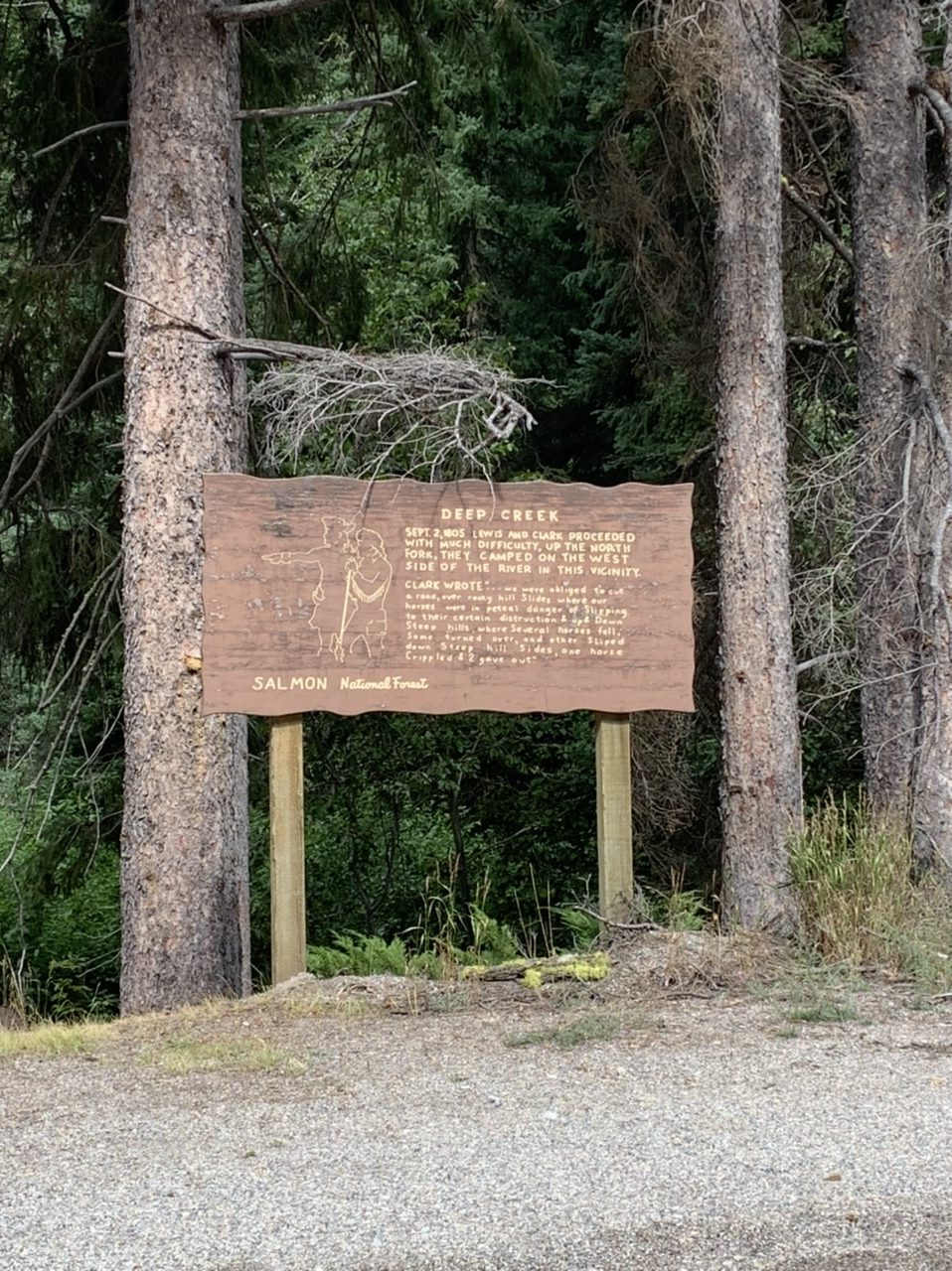
Early on down this road there was a whole lot of evidence of forest fires past. I would always examine them and try to figure out how long ago the fire was based on undergrowth.
The official Adventure Cycling Association maps I’ve used since Hartford, Illinois (just north of Saint Louis) directed me into Missoula proper, but in reality Lewis and Clark didn’t make it that far north. At Travelers Rest they headed west through the mountains again, via the Lolo pass, a Nez Perce trading road that follows a ridgeline of the Rockies for about two hundred miles. I was only twenty miles away from Missoula at Travelers Rest and decided to forgo biking there. Theory: the Adventure Cycling only directs through Missoula because that’s where their official headquarters is. So just as I drove into the city after lunch and a jaunt through a state historical site, the next morning we drove back to where I left off before I started on my final mountain pass.
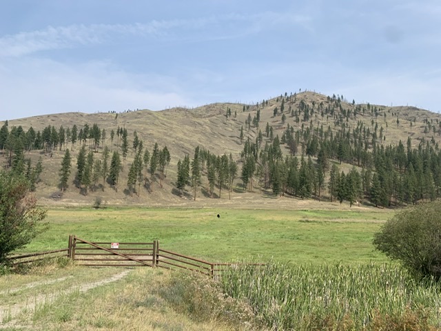
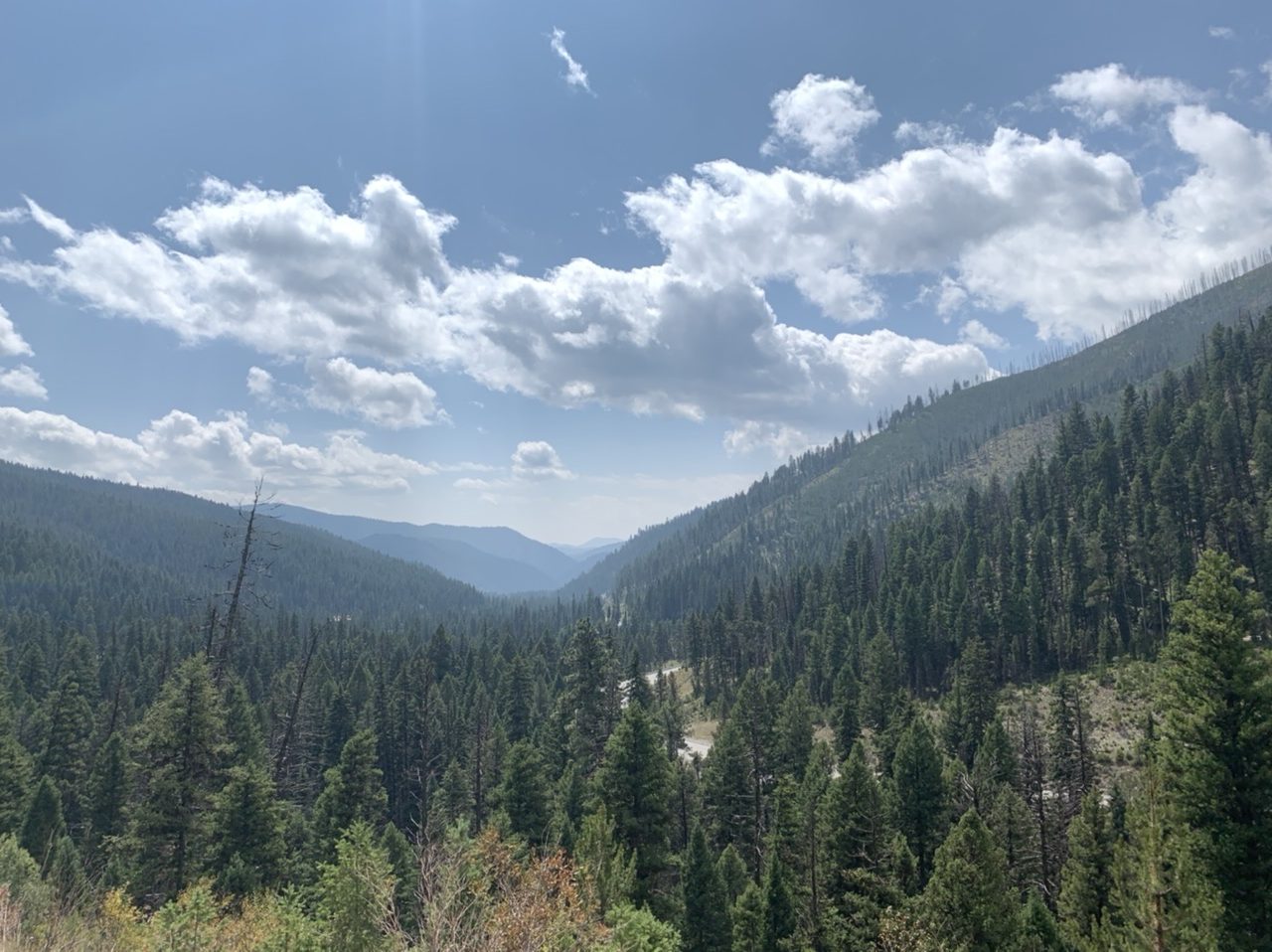
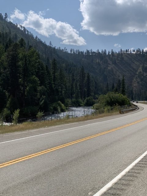
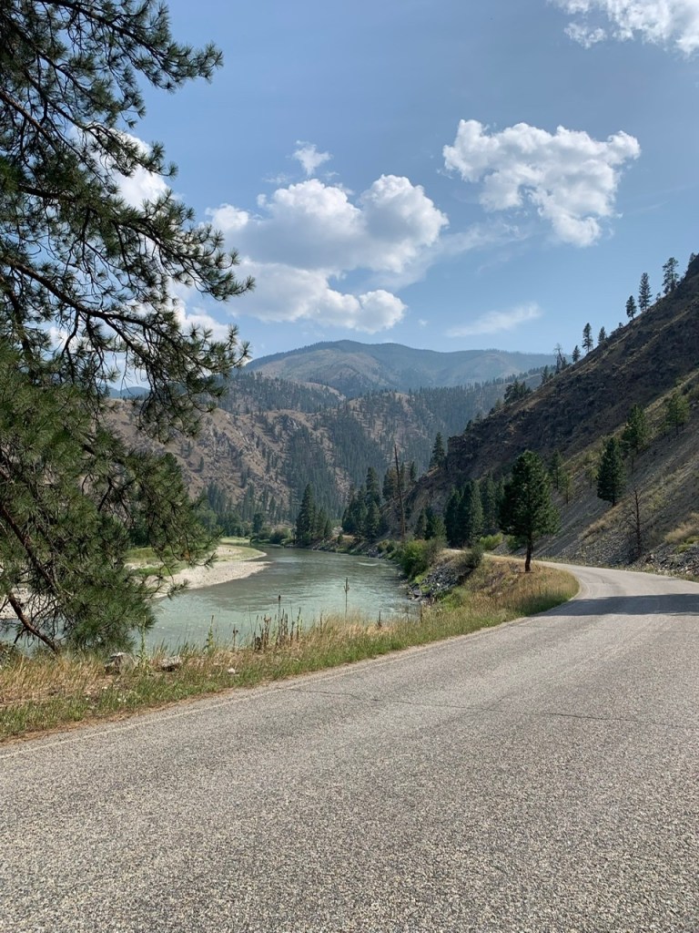
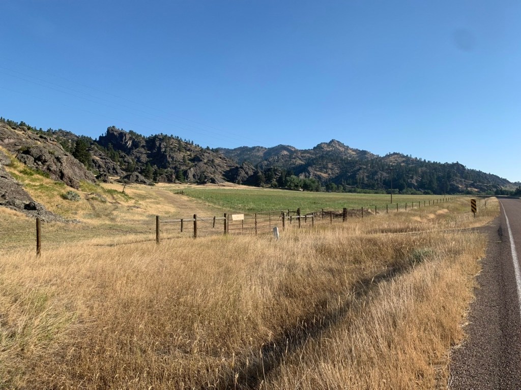
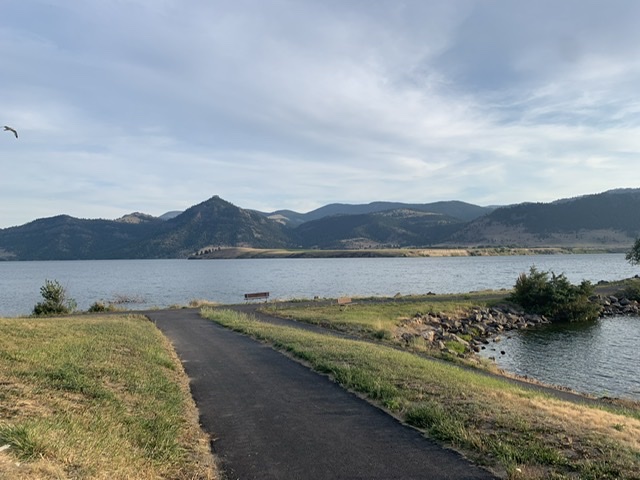
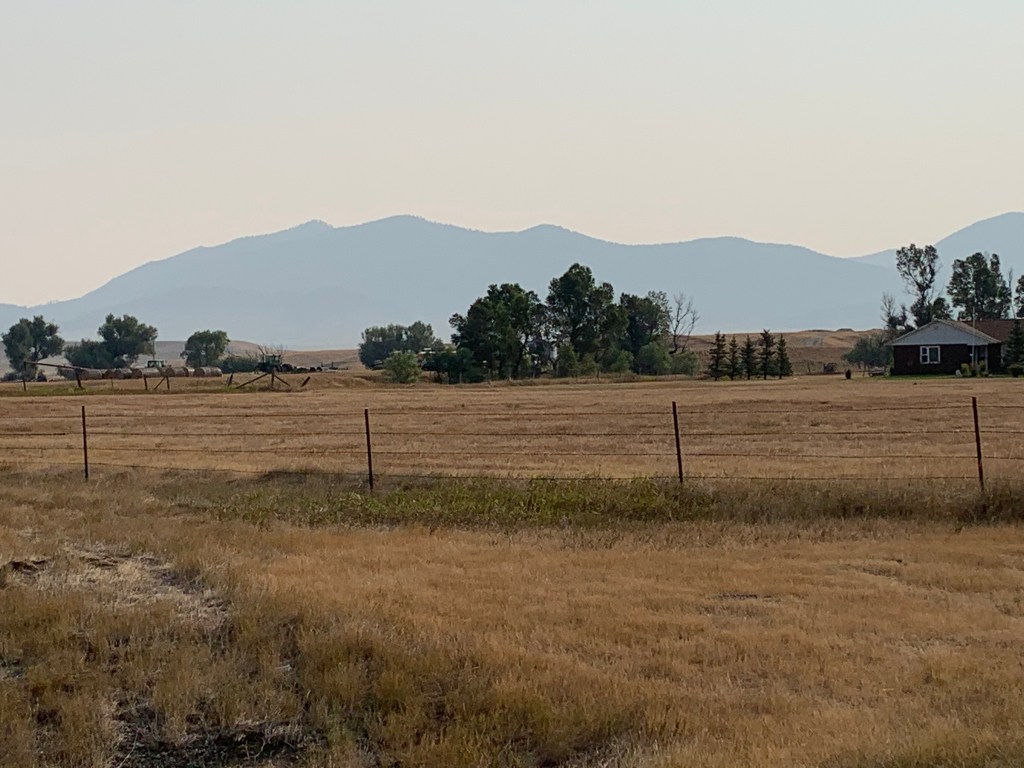
I don’t think I’ll ever get over how pretty the Rockies are. I’ve seen them and driven through them in a lot of states at this point–heck, I’ve biked through a lot of them and I just can’t stop taking pictures.
Cycling maps can be particularly confusing. Since between bike paths and gravel roads, they often lead riders onto roads not oft traveled, a regular road map doesn’t suffice and they are made up of a number of close-ups at a variety of different scales. I’d gotten pretty good at reading them. I got the elevation graphs, the mileage, what was a turn versus a waypoint. I didn’t even need a whole hand to count the number of times I’d made a mistake. Heck, I can only specifically remember two instances. Even if there were more, as I neared the end of my journey and fast approached 5,000 miles even if I made one or two more mistakes I’d forgotten my record was pretty good. This mountain pass error wasn’t about going in the wrong direction. This was misjudging where the peak of the mountain was. Usually I try not to end my day by climbing a mountain. Well, this time I did.
Is that a bear or is it a cow? That is a question I often ask myself when I spot something black or brown in the distance. I had a lot of these “sightings” on the Lolo Pass, but I could at least laugh when I realized my mistake.
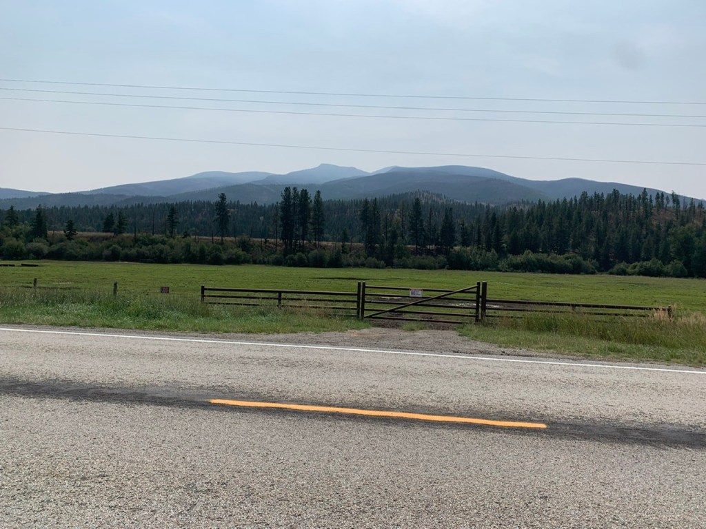
A good portion of this road was ranches interspersed with pine trees. I felt safer than I had on previous passes and a whole lot more confident about bears. Generally they don’t hang out in settled areas. My mom and I stopped for lunch at a picnic area–I may have been a little twitchy about some spilt jelly, but it was nice not feeling like the wilderness was an impossible task anymore. I passed moose crossing signs and elk crossing signs. I thought I might actually have a sighting considering I wasn’t in a noisy car, but it was quiet save for the occasional car.
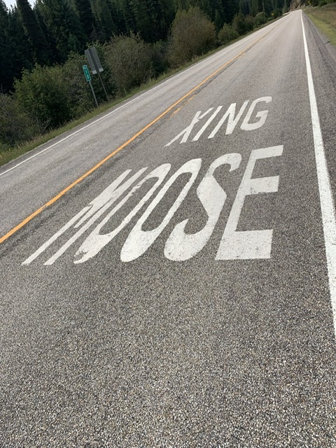
I saw moose xing signs painted on the road a few times. It’s pretty brilliant to make the signage this obvious. One does not come out alive after hitting a moose at 50mph. I did keep reading it as XING MOOSE though.
I talked my mom into booking a cabin at Lolo Hot Springs because it was on my bucket list to experience a natural hot spring, so my mom and I met in the parking lot for this camping resort before my final stint. I wanted to stop at the Lolo Pass Visitor Center. It would be an hour or two before they closed, plenty of time to experience whatever exhibits they had there before we went back to the camping cabin.
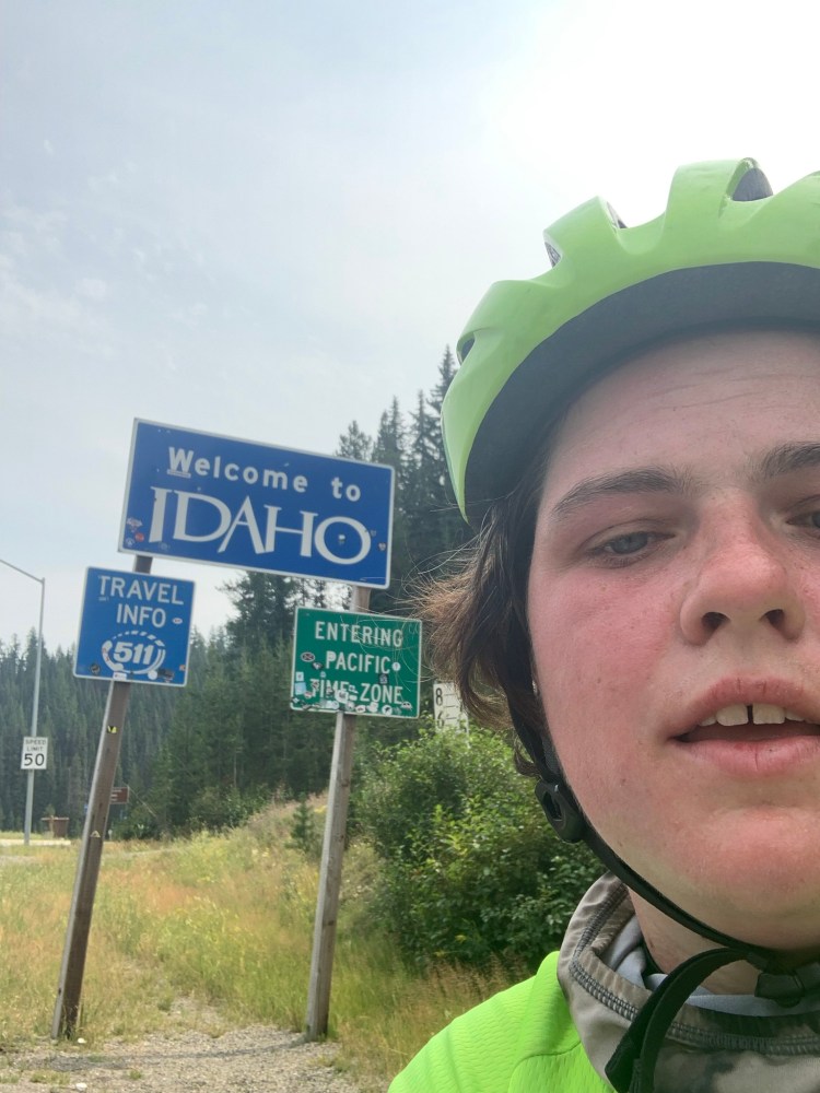
I was under the impression that I only had about ten miles to the visitor center. It was closer to twenty miles of the steepest consistent slopes I’d experienced thus far. I kept on telling myself it would be soon! I’d get there soon. I expected to reach the visitor center in about an hour. Instead I arrived at the top close to two hours later. I got there though and I was back in Idaho. The visitor center was still open, so I looked around, I brought my maps in to talk to an NPS ranger about the alternative route along the actual pass Lewis and Clark traveled. I knew it was a gravel road and I wanted to know the conditions. I found out that a good chunk of it was closed due to fire vehicle traffic, that there were roads that got up to the top that my mom’s Toyota Corolla could handle, but the actual trail was a four wheel drive situation.
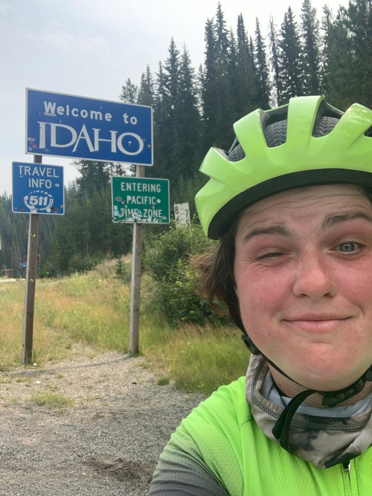
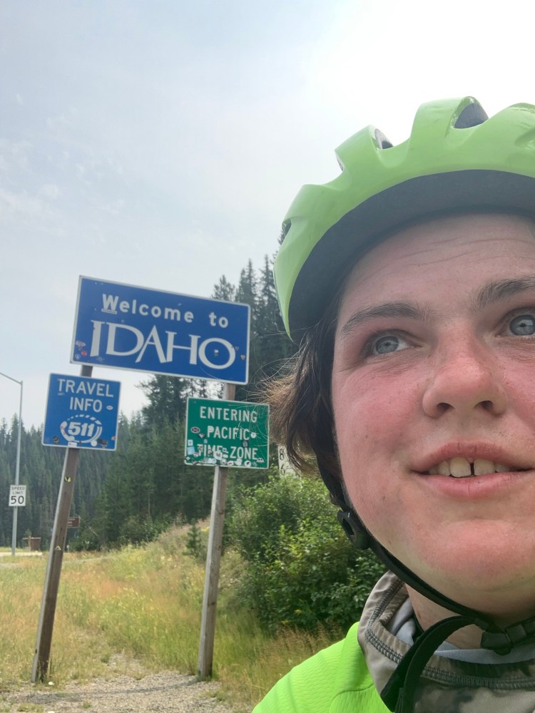
I took about 20 selfies in front of the Idaho sign because I was too tired to not look manic when I tried to smile at the camera. There hadn’t been a sign on the Lemhi Pass so I was set on getting one here.
I was physically and emotionally exhausted, but I popped my bike onto the bike rack and we headed back down in the car. My mom was loathe to re-enter Montana after we had spent so much time crossing it, but first thing in the morning the next day we would start out in Idaho headed for Washington.
There was a bar where we got burgers for dinner, then we ventured into the hot tub. It was pretty disappointing. Yes, the hot water was natural, but it was basically a heated pool with a ledge for seating. You soaked indoors with strangers–in our case grumpy, snobby strangers who were horrified by the lack of luxury in this hot spring in the middle of nowhere Montana. I think I had more reasonable expectations. I had done a lot of research before hand to find a place with an outdoor hot spring. I was picturing being out in nature, sitting on rocks to soak. I waffled a bit about which place to go or if we should even do it. It was not what I was hoping for. I knew there was another hot spring down the road, that after a brief hike, about a mile you could soak in actual natural hot springs. I didn’t think my mom would want to hike there. If I hadn’t just biked up a mountain I might of pushed it, but I was wiped.
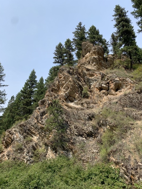
There were some really interesting, textured rock formations around the campground and just past it. I get excited whenever something looks different from anything I’ve already seen.
Our cabin was…well, odd. It wasn’t rustic wood, it was dry wall, basically a mini hotel room, which would have been fine if not for the bed situation. A creaky metal bunkbed. I enjoy bunkbeds in cabins generally, but climbed up and every time I shifted my body the entire bed shook and creaked. I finally climbed down and squeezed in next to my mom in the full size bottom bunk. It was tight quarters.
First off, sorry for the lack of posts last week. A week ago Friday I got into a car accident. I was rear ended while driving on the highway and injured my back, and I was in too much pain to concentrate on writing. Today’s a little better, so I’m going to push on. So let’s pick up where I left off.
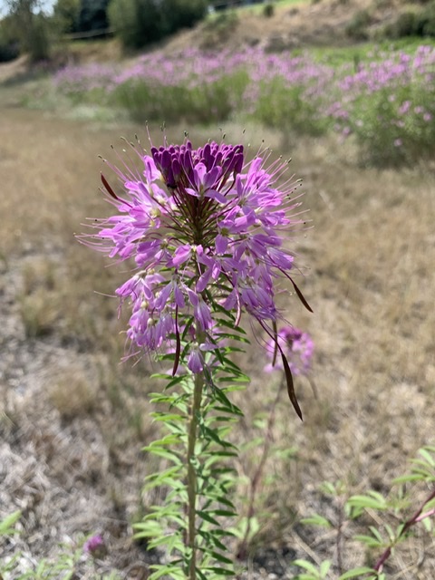
Ever the amateur botanist, i was intrigued by this flower. I’m searching for a book on all of the plants and animals Lewis recorded in his journal
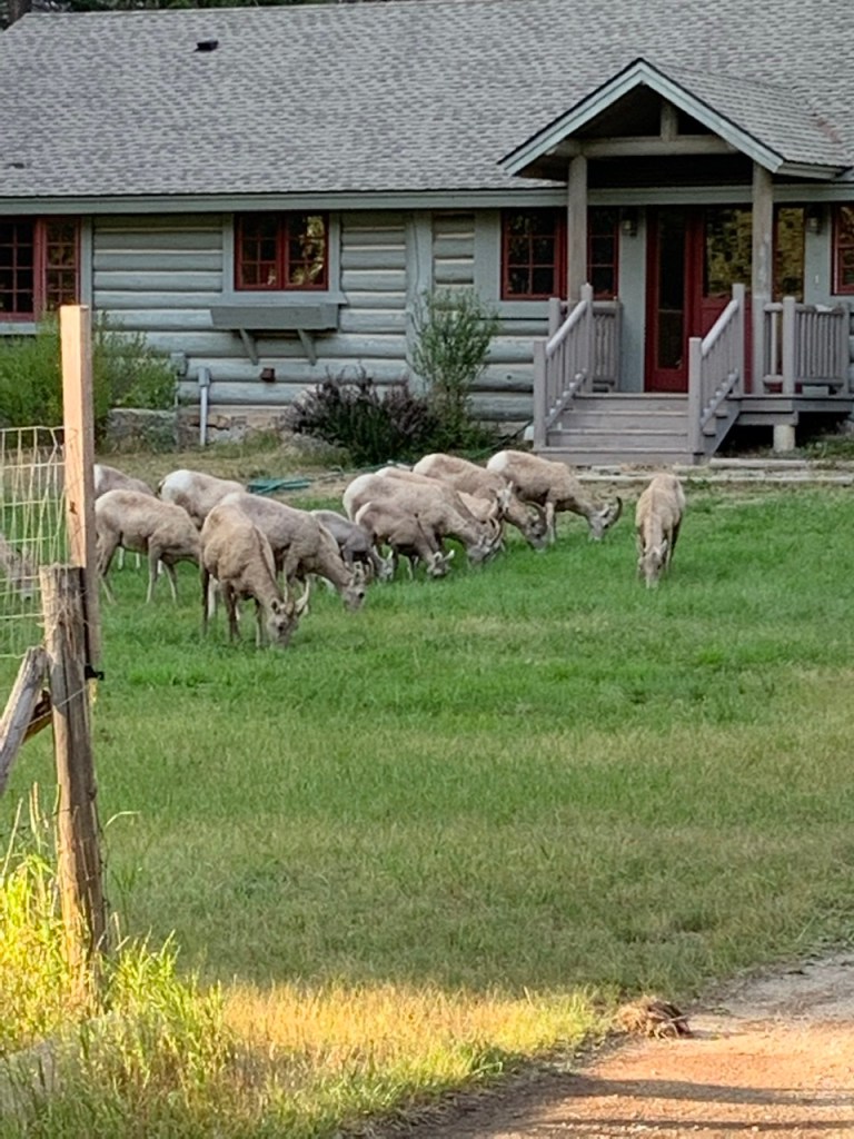
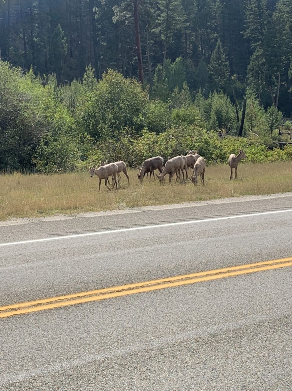
It was cold and still early in the afternoon when we got to the campground, so my mom and I decided to go on a drive and explore. We followed a sign for a wildlife viewing area. A viewing area we did not find, but we drove through open fields, by an old schoolhouse, and down a winding road by a creek. Eventually though, we saw wildlife. There was a large herd of big horn sheep, hopping down a mountain to graze in someone’s front yard. We’d been trying to catch a glimpse of these elusive creatures since the Gateway to the Mountains, and here they were, hundreds of miles later, two sightings within 24 hours of each other. That night it was so cold that we rushed out of the campground in the morning. We didn’t even shower that morning, even though we had the option because we couldn’t fathom getting undressed in that temperature.
My new big horn sheep friends near Sula Montana
The next morning we grabbed breakfast at a bakery in town. As I got out of the car I saw a bunny—not the normal kind of bunny though. This bunny was chocolate brown. It looked like someone’s pet. But there wasn’t just one. There were two! I started following them because I may have been in love with them…and alarmed a business owner when I was hovering around his parking lot. I asked him about the bunnies and he said someone had let bunnies loose in town and they were all over the place now. The ride from there was pretty uneventful. There was a paved bike path all the way to Missoula. While I glided along with no cares or worries, my mom was white knuckling the steering wheel. She went on ahead when it evidently hit her that the bikepath strayed away from the road occasionally, so if something happened to me while I was biking she wouldn’t be able to find me. I’m not sure how a bike path could possibly be more dangerous than biking in the road. I mean, it’s not an impossibility but I’m sure statistically I was significantly safer. At any rate, my mom saw an ambulance go by and panicked, assumed that it was for me and backtracked to try to find me. Fortunately I was by the road at the moment she passed me, so I gave her a pleasant wave and continued on.
One of many photos of the mountains I stopped for on my ride to Missoula. I snatched every opportunity I could to get pictures of the mountains without a halo of smoke.
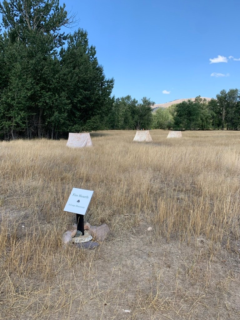
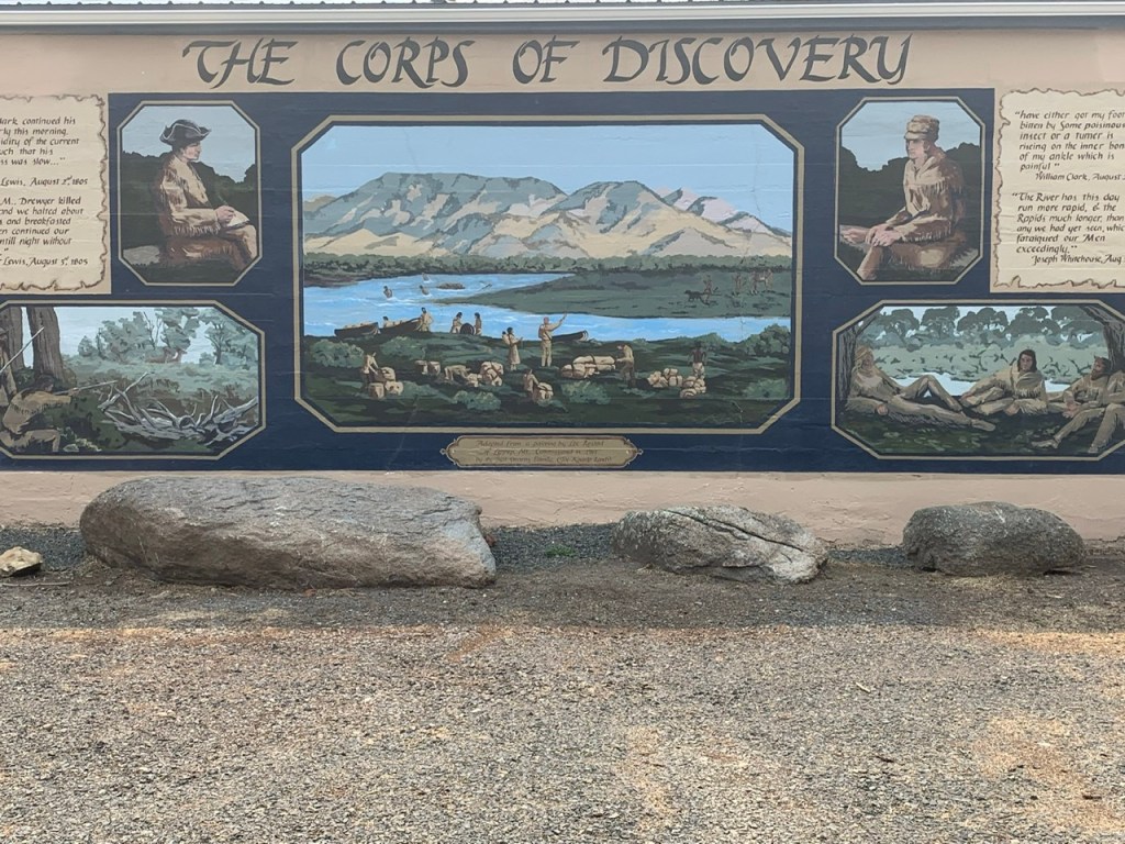
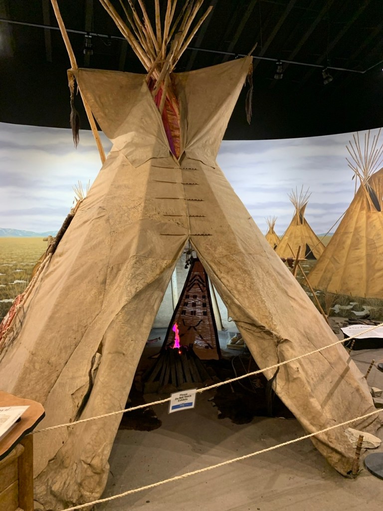
We had some trouble meeting back up, and it was only one more stint before we got to Traveler’s Rest, another Lewis and Clark interpretive center and the road I’d be taking toward my last mountain pass. When we stopped at the interpretive center, I discovered the woman on duty was from Massachusetts. We chatted for ages. She was from the South Shore and I got her talking about Bridgewater Triangle experiences (a hub for ghosts and the supernatural in Massachusetts). We talked about plants and animals in relation to Lewis and Clark. I left with a few book recommendations and went on the short self-guided walk-through Traveler’s Rest where they set up a replica campsite. Archaeologists found trace evidence that the expedition had stayed in a grove there and signs pointed me to the exact spot. The main proof is mercury content in the soil at the sites of their latrines because they used a cure-all medicine that had an incredibly high mercury content.
The reproduction of a Corps of Discovery campground at Travelers Rest in Montana.
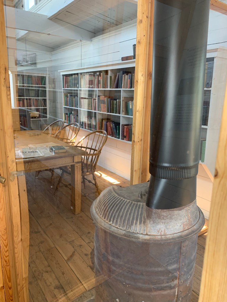
From there we drove to Missoula on move-in weekend for the college/colleges in town. We stayed in a cabin at the biggest KOA I’ve ever seen. It had everything, a swimming pool, a hot tub, they even had food trucks regularly scheduled. That night it was gourmet hot dogs. I suggested we go to REI to pick up long underwear so we could handle the cool temperatures at night. The next day we visited the Fort Missoula Museum. The indoor portion of the museum had an exhibit on forestry and wildfire fighting and an exhibit on WWII Japanese internment camps that was very sensitive to how heartbreaking the subject is. The museum is primarily outdoors. It’s comprised of a number of historical structures, from parts of the fort to an old homestead, schoolhouse, a train car library (I had no idea that was even a thing) and a fire watchtower. For a while now I’d been half joking half completely seriously telling my mom I wanted to get a job as a firewatcher so I could sit in a tower in isolation, watching for fire and writing. My mom told me Jack Kerouac was a firewatcher. I’m doubling down now.
a fire watchtower (left) and the interior of a library train car (right) That’s how people on the frontiers got access to books back in the day. Such a limited selection!
Afterwards went to a used bookstore the women working at Traveler’s Rest recommended. I bought many books. I have a problem.
Ice cream that night, an interview about my trip the next morning, and then back to Traveler’s Rest so I could bike my last mountain pass.
One of many, MANY gorgeous views on the Lost Trail Pass
The next morning I was ready to conquer this mountain! However, my bike was not. Overnight my rear tire went flat (it’s always the flipping rear)! My morning started with a tube change. The only tube I could find was still in the box didn’t even have a cap on it. I replaced the tube and crossed my fingers that I didn’t get a flat on my way up the mountain. I figured I’d either get a total flat by the time I got to where I’d start biking or it was a slow leak, and as long as I brought a spare tire and a pump, the worst case scenario was biking would be difficult.
Look at the beautiful clear skies on the Lost Trail pass!
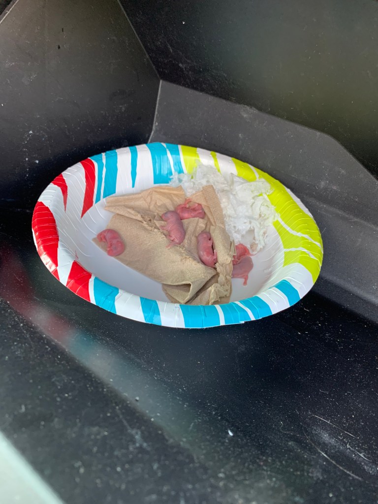
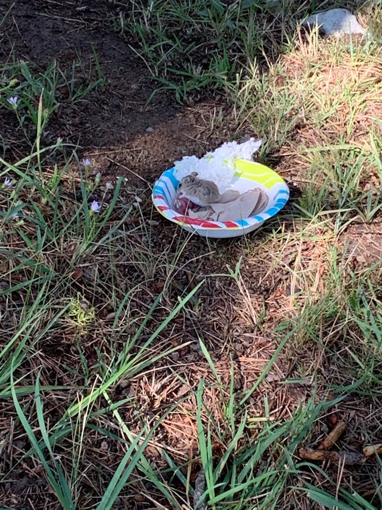
The Lost Trail Pass was my second mountain, it wasn’t as tall as the Lemhi Pass, but perhaps because there was far less smoke and I could actually see in front of me, it felt bigger. We returned to the cabin we stayed at the night before, pulled into their parking lot so I could get my gear on. I have UV sleeves and on chilly mornings I’ll put them on both for protection from the sun, and a tiny bit of extra warmth. If I wear a sweatshirt or a jacket, within 15 minutes I’m sweating and regret the decision to bring it along. I opened the glovebox to get the sleeves and shrieked. There were at least six baby mice in our glove box and a mama mouse that was freaking out even more than I was. It came as a shock, I’ll admit, but despite my racing heart, I was calm in a crisis. I told my mom to grab paper bowls from the back and used a napkin to gently transfer the babies into it. I needed to first empty out the glove box to make sure I had all of the babies, and second, find the mama and get her out. I put the bowl with the babies in the glovebox with nothing else. Mama mouse came back in a panic and grabbed one of her babies to hide it back in the dashboard. I asked my mom for an almond from our snack stash and another paper bowl. I placed the almond like bait and waited for mama mouse to come back, then snapped the bowl over all of them, took the lot out of the car and into the nearby trees, and left them there. Mama mouse immediately went out to explore her new surroundings, but she did go back to the bowl to check on her babies. I wasn’t sure if there was another mouse, so we continued to be on high mouse alert for weeks. There was a baby hidden somewhere. Fortunately no smells emanated from the dash in the coming weeks. I’m sorry, baby mouse!
Baby mice in our glove box! I fished them all out and left them at their new home!
And that’s how I biked my second mountain pass, with my heart rate through the roof before I even began pedaling. It was tough, it felt endless. There were switchbacks around ravines and steep climbs. As I neared the top every curve felt like it just had to be the end, but it wasn’t. I had my bear mace and my bell. This road was paved, so the bell didn’t really ring on its own the way it had on the Lemhi trail. I rang it myself every 50-100 feet and kept music playing constantly from my phone. I pushed myself, fighting a continuous climb up, thinking about how this was supposed to be an easier mountain, how was it not easier? Then it hit me. That inner-tube…
A historical marker on the Lost Trail Pass
I had a slow leak, not enough to make me skid out, but I was biking on a very squishy tire. I stopped to give the tire a pinch and found it was almost completely empty. I had foreseen this possibility. Instead of my usual back-up chargers I’d put a spare tire, tire levers and my hand pump in my handlebar bag, so I pulled over, put my bear mace accessibly in my cycling jersey pocket–I was not going to have a bear sneak up on me while I put air in my tire. I loathed every single car that passed me. They saw me struggling. It was obvious I’d broken down in the middle of the mountains and not a single one stopped to see if I was alright. If I wasn’t, I had no gear on my and I was about as far away from help as I could get.
I got the tire pumped as much as I could with my measly little pump. The best I’ve ever gotten it is about 40 PSI which is just over half the recommended pressure for my tires. Still, it was better than no pressure at all. I made it to my mom who was waiting a few miles up the mountain with pb and j on a flour tortilla (my go-to cycling lunch) ready for me. I gave myself some time to recoup. That ordeal coupled with the mice from that morning had made the past five miles some of the most difficult I’d experienced so far. I had a regular bike pump in the back seat, so I pumped up the tires to a better PSI and made a note to check them every time I stopped. I had no further problems, beyond wondering when this mountain pass was going to end. I saw cars and trucks puttering up the road, taking a curve or a switchback and continuing up the steep climb. I kept on thinking “it has to be soon. It has to be soon.”
A whole bunch of Big Horn Sheep on the side of the road
The mountainside was so steep in places I didn’t feel so worried about bears. There weren’t a lot of places to hide on those sheer drops, but after them there would be a crevasse filled with berry bushes and I would jump back to high alert. Because of this, and because the road was populated, unlike the Lemhi Pass, I felt I could stop this time and take pictures. There were even the occasional historical markers I love to see. Finally I reached the top. Again there was a road closure due to fire vehicle traffic, but this time it wasn’t the road I was taking. I got to enjoy the downhill. We were back in Montana.
After the mountain pass i biked for miles in a very flat valley alongside a beautiful little river called the Bitterroot
And enjoy it I did! I got as high as 35mph. My bike was steady, my tires were behaving, and I coasted about 20 miles. I think my mom was as shocked as I was that I biked up a mountain and still managed to bike nearly 50 miles in a day. We met up at about 20 miles and stopped at a campground shop in Sula, Montana for ice cream. We decided to camp there. They had showers and were decently populated, which meant bears were less likely to come clawing at our tent in the night, and the ultimate luxury, Wi-Fi! I did bike another twenty miles past the campground and backtrack. We were nearing Missoula and I wanted to reach the city the next day.
This week’s Tuesday post is going to be delayed. I’ve had limited service, and while i had already written at least half of my post written it was hidden in the depths of my harddrive and took me way too long last night to track down.
I followed a hardly trafficked road that ran alongside a freeway, constantly passing underneath overpasses and wondering to myself what I would do if a bear was just chilling around the next bend. The landscape was bleak, rock dirt and stifled, dry grass. There were a bunch of campgrounds concentrated around a reservoir called Clark’s Canyon, so as I neared the end of my planned mileage, we paused to look at our options. The wind had been fighting me most of the day so far, and up above this reservoir they were fierce. We chose a campsite and put up our tent, struggling just to keep it from flying away. My temper was short. I was hungry and exhausted and scared to lose our shelter. The ground was so hard that our stakes bent when we drove them in the ground. We did manage to get the tent up and filled it with our suitcases and camp chairs so it wouldn’t fly away the moment we looked away. The wind blew so hard the tent was flat on the ground more than it was upright.
The wild winds of Clark Canyon. We thought we’d be blown away–or at least the tent would be!
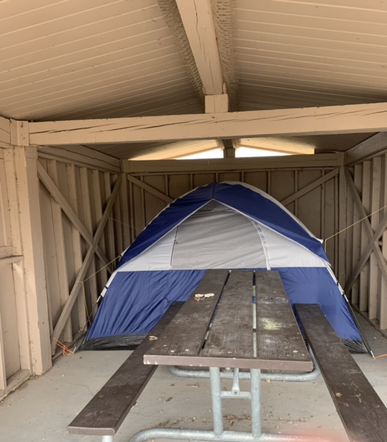
Our campground had picnic shelters at each site, so I decided we’d move the tent inside of the shelter to shield it from the rain. The ground was so hard it was difficult to pull the stakes out, but we wriggled the tent in the shelter and I used paracord to tie it down. It worked out well, though the picnic table was chained to the ground, so we had some trouble getting in and out of the tent door.
My brilliant tent solution to high winds in Clark’s Canyon
With that achieved, I went back to the road to finish my mileage. My mom stayed behind for a bit to try to join a zoom call she has every Tuesday. The wind was fighting me as she passed me, and shortly after it started to rain. Not just rain, but freezing rain that jettisoned toward me with the force of that intense wind. I was being pelted, and despite the fact that I was going down a mountainside, the wind was so strong I was barely moving forward. And of course I left my GPS tracker in the car, so I couldn’t sent out a distress signal. I thought my mom was psychic when I saw her heading towards me. She came back to ask me if I wanted my raincoat and I told her “I’m not doing this” Loaded my bike on her car and headed back to the campground after only a mile or two. The rain calmed, my mom and I played card games, made dinner, read Dracula and went to bed. It was supposed to rain that night and threatened to rain most of the next day. I didn’t want to bike up a mountain in the rain. We heard the thrashing wind all night and were both sore the next morning from sleeping on concrete (sleeping pads can only do so much). We waited til morning to make the call. It had rained and thundered so much in the night that the clouds had rung themselves dry. I didn’t have to delay anymore. I was going to bike the Continental Divide.
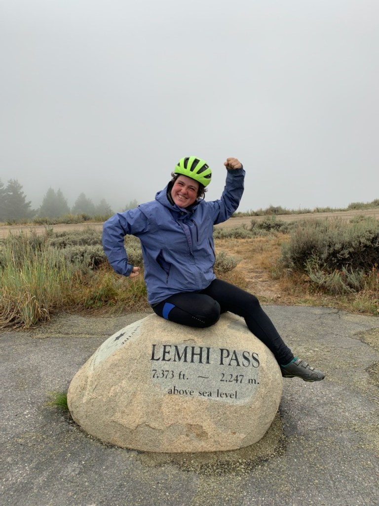
Lemhi Pass on my way into the continental divide. Can you even see the mountains?
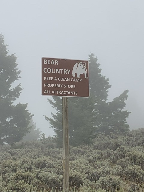
I biked through sparsely populated hills till I got to the gravel road, the Lemhi Pass. It warned me that this was a public road through private lands. I biked through cow pastures covered in sagebrush, stopping occasionally to carry my bike over cattle guards. I got up close and friendly with a number of cows just chilling in the road, and for a long while I had my music cranked up so I didn’t have to worry about sneaking up on bears. I gave up on the music. I could hardly hear anything over the sound of my tires on gravel. I had a bike bell on my bike so I attached it in a way that made it wring from the vibrations of the bike so I could make constant noise. There was a drastic change when I passed the final ranch. It went from stark, desert-like scenery to mountainsides covered in pine trees, roads overwhelmed by clusters of berry bushes. Places for bears to hide. The mountains were misty, or more likely smoky, and the higher I got the more the mist clung to the mountaintops and obscured what was ahead of me. I told my mom to meet me every five miles, not because I needed a break as much as I needed a few minutes where I didn’t worry about bears. As I neared the top there were fewer and fewer places for my mom to stop. I knew the peak was soon so I asked my mom to meet me in two and a half miles but she was nowhere to be found. I was shaking when I got to her, I was so tense. I couldn’t see what was around the next bend, I couldn’t see more than 10 feet in front of me!
I made it to the peak of the Lemhi Pass. The Continental Divide!
I made it to the top before I even realized what it was. It was near the intersection with the Continental Divide Trail. A road closure barricade blocked the road with signage that said it was closed for fire vehicle traffic. Just past that point there were dozens of army issue tents that I guessed were for the wildfire fighters. There was a huge fire not far from where we were. The mist I’d been experiencing had more than likely been exacerbated by the smoke. I left my bike by my mom’s car and walked up the road. I didn’t want to get all this way not to make it to the top of the pass, but not far from where I stopped there was a marker that marked the Lemhi Pass and the Continental Divide. I dragged my mom to it to take pictures, feeling a strong mixture of relief and disappointment. The best thing about going up mountains is getting to go down them after. I had made it to the top of this mountain, I did the hard part, but I didn’t get the reward of biking down the other side.
There was supposed to be a Sacagawea interpretive and picnic area not far away, so my mom and I snuck past the barrier to explore it, only to find dozens of army issue tents camped out. It seemed this is where the firefighters were sleeping. I took over the driving and got us down the windy gravel road, found another pass, again on an endless gravel road and drove us to the other side of the pass. I thought about stopping at the crest and biking down the other side, but the moment was passed and my mom and I were more concentrated on getting to Salmon, Idaho where we planned to stay the night.
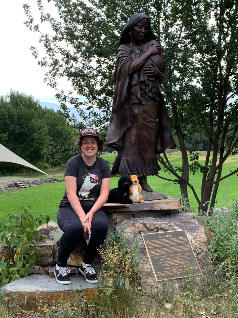
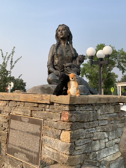
The Sacagawea Interpretive Center in Salmon, ID
The next morning we backtracked to where I was supposed to pop out on the other side of the Lemhi Pass and I biked back to Salmon. I biked about half of my intended miles and took a break so we could visit the Sacagawea Interpretive Center where coincidentally they happened to have an interpreter named Judy giving a talk about Sacagawea. We stuck around and I met a kindred spirit who had become enamored with the Lewis and Clark Expedition the same way I had. She told us she was giving her favorite talk the next day, about highlights from the Journals and that we should come back if we were still in town. We back-tracked again, I finished biking to and past Salmon. My mom and I started looking for a campground closer to my end point. We stopped at the place I had suggested. In the tenting area there as a tent surrounded with a two-foot stack of railroad ties. I had heard of people doing this sort of thing to keep bears out, but this really freaked me out. Yes, bears are a big risk out here, but did this stranger who didn’t even seem to be there, know something we didn’t? Or did this camper do this because they planned to keep food in their tent or some other thing that might make bears more likely to harass this campground? I didn’t want to stay to find out.
If you think I’m exaggerating or overreacting about being in bear country, just try staying sane when you’re confronted with this all of the time!
A Frustrated, we went back to Salmon and found a nice RV park that felt a whole lot safer. That’s where we chose to stay the night. The next morning I biked as far as a spur down one fork of the Salmon River that William Clark explored. We drove down it for a bit to take pictures before we went back to Salmon for the second Lewis and Clark talk. Judy talked about highlights from the journal, and like a true Lewis and Clark fangirl I got excited and could identify what story she was telling a few words in.
The gorgeous Salmon River!
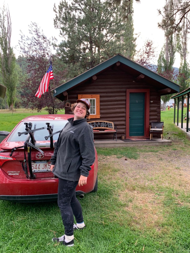
We returned the Salmon River and I kept going toward my next mountain pass. We stopped at a camping resort. There was both RV camping and tent camping, but we decided to check a small item off my bucket list and stayed in an inexpensive cabin. The campground had a Mexican restaurant that had next level carnitas and homemade tortilla chips. Of all the places! I’m pretty sure the family that owned these businesses were the entire population of the town.
Our cabin at Broken Arrow in Gibbonsville!
It rained. No, it poured in the night, and it continued to pour all the next day. Generally I push through rain, but I knew I was doing a mountain pass. I was worried about visibility and my tires maintaining traction on the road, so as if we were stuck in Ground Hog Day, we headed back to Salmon to spend the day hopping around town. We went to the local museum. Local museums out west are often like exploring a well-organized attic. They always have vintage clothes and accessories, various collectable items. It seems as though when a family member dies and the family finds something they find interesting, they donate it to the museum. They’re always an eclectic blend of artifacts, and more often than not admission is by donation. The next day I’d biking another mountain pass.
Sea and Pomp in front of the Sacagawea statue in Three Forks, MT
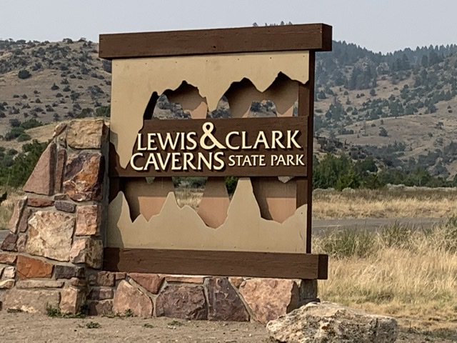
The next morning, I biked the last few miles to the Headwaters of the Missouri River. It didn’t hit me until I called my dad and he said I’d biked the entire length of two of the most major rivers in the country that it really hit me how much I’d done. I was radiating joy. For so long my milestones had been checking off each new state I entered. It was a success, a moment of happiness, but it did give me pause. I only had so many milestones left and one of them was quickly coming upon me. The Continental Divide. We had plans to stay in Three Forks that night to charge up our devices and take a shower at the motel in town. Prices were exorbitant, but it was a weekend and there was a music festival happening not far off. It was difficult to find any sort of lodging, camping or otherwise. I kept biking, but after a certain point I met up with my mom on a road with no shoulder to take a break. The drivers were so angry and aggressive and there was just so much traffic, that I had my mom push on down the highway. We were curving around the bases of cliffs, so there weren’t any pull offs on our side of the road. With the curves, the speed these Montana drivers were going, and the curves they were going around, added with the lack of shoulder (the line was painted on the grass in places) I gave in, and my mom and I went to Lewis and Clark Caverns to explore instead. We caught a glimpse of the enormous festival as we drove by. Seriously, there’s that kind of traffic in the middle of nowhere Montana? I’d venture to guess that thousands of people had showed up for this festival by the look of the crowd and the field covered in tents and RVs.
My mom doesn’t like caves the way I do. Any time I’m near somewhere that has a cave I want to go in it. I hope to see crystals inside, or rock formations I’ve never seen before. The last time I’d had the opportunity was in South Dakota, again with my mom. I convinced her to go on the easy tour with me, but I was disappointed I didn’t go on the long one. I believe it was Jewel Cave in the Black Hills, and it sounded like the longer tour had you squeeze through holes and cervices to see frost crystals on the walls of the cave. So in the hopes of having one of these experiences myself, I went on the longer tour and left my mom to wait up by the car. There were no crystals, but I got to slide down a slick bit of stone and climb around like the adventurer I claim to be, plus I saw bats! We headed back to our hotel, grabbed the best country fried chicken I’ve had in a very long time just outside of Three Forks, and got back on the road the next day. I tried hard not to guilt myself about how few miles I’d done. If I’d been there on that highway after the music festival was over and the traffic had dissipated, I would have biked it no question. I didn’t even skip that many miles, I just stopped in early afternoon.
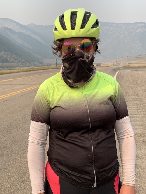
I biked with my neck gator over my mouth and nose to protect myself from breathing in particles and smoke from the nearby wildfire. I felt like i was in a neon Mad Max movie.
My mom dropped me off at the entrance of the Lewis and Clark Caverns the next morning. The roads still didn’t have much of a shoulder, but past the festival the traffic wasn’t quite so bad. I dealt with a lot of RVs angry that I had the audacity to bike on the road. I cruised up and down, stopping at occasional historic markers and trying to describe the scenery in my head. I made up some of the mileage I’d missed the day before. Months ago my mom sent me an article about murals in Montana that a town was looking to restore. The town was called Whitehall, and I hadn’t even thought about whether or not my trail went through there until suddenly we were in the town, and I started to see the murals. My mom and I took our lunch break there and drove from mural to mural taking quick photos before I got back on my bike and headed toward Dillon. Somewhere after that, purely by chance I found a Sacagawea interpretive park. Not long after that I reached Beaverhead Rock, the first landmark Sacagawea recognized on the journey West, and the first sign that her people, the Shoshone would be nearby. This was the first of a few instances where the map advertised a state park, but there was no entrance, no place to drive in it. The GPS directed to nothingness, but as I continued up the road, there was a pull-out with signs and a viewpoint area.
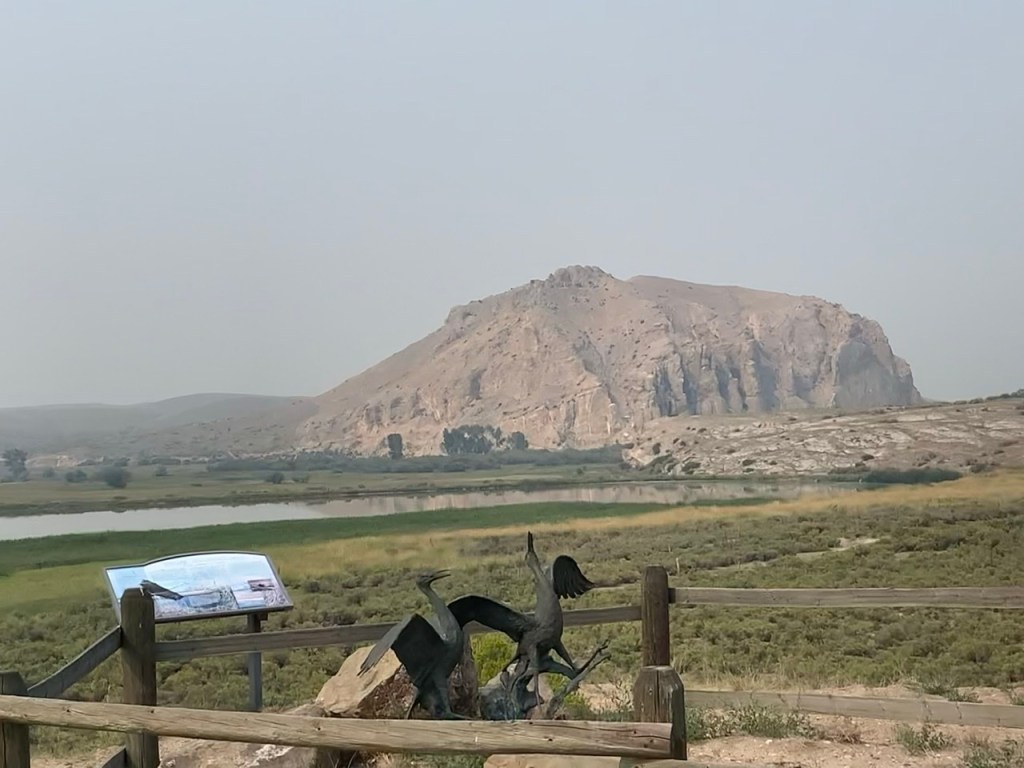
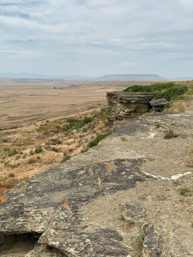
Beaverhead Rock was pretty cloaked in smoke. It was an important landmark on the Lewis and Clark Expedition, a landmark Sacagawea recognized as on the way to her home.
I was frustrated with the smoke and took far fewer photos than I usually do. The smoke made everything cast in a blur. Any pictures I took would be a foggy mess. I did at least take photos of Beaverhead Rock before I kept on pedaling toward Dillon. I was exhausted at the end of the day. I usually met up with my mom every 10-15 miles to sit down, drink water and take a break, but I was so tired before my last stint, I told my mom I had to stand for this break, otherwise I wasn’t going to be able to keep going.
One of the Lewis and Clark murals in Whitehall, Montana
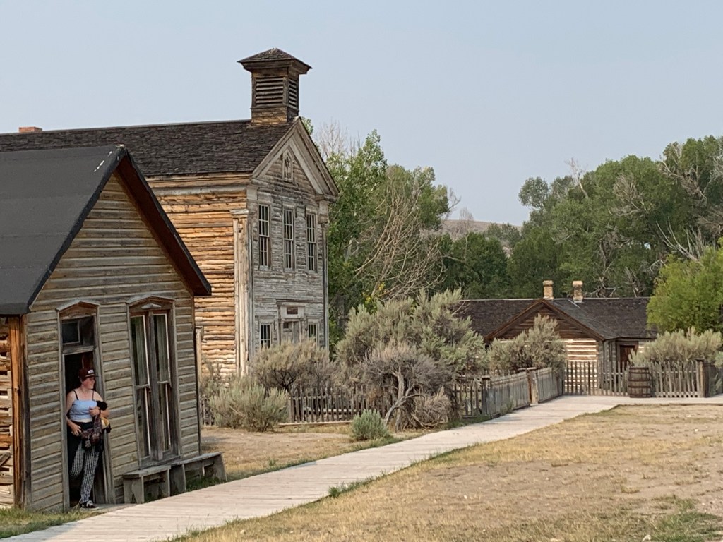
We found a place at a KOA in Dillon, and after some brief discussion we agreed that I should take the next day off, since it would be our last time near anything before, I did the Continental Divide. I complimented a neighbor’s puppy and wound up talking for a long while with him about my bike trip. He was excited about meeting me. He said his wife was always the one who met interesting people, but now he had a chance to one-up her. He even wound up donating some money to my trip! He was there with his kids to celebrate his daughter’s 21st birthday. They went to Bannock State Park, a ghost town a half an hour away, and he highly recommended it, so the next morning my mom and I went there to explore. “Arrested Decay” seems to be the goal of many state parks with crumbling structures. I told my mom this was the closest I was going to get to being an urban explorer. I’m intrigued by the concept, but the trespassing aspect has my goody-two-shoes attitude shaking in its boots. That’s much the same reason I didn’t stealth camp on the road.
Photos courtesy of my mom. Bannock State Park (a ghost town), and one of many painted advertisements in Butte.
We had fun exploring that morning, then headed toward Butte, mostly because I was dying for a shirt that says “Ain’t She a Butte.” There was also a brothel museum up there I was curious about. That was closed and we had no success finding that shirt. My mom didn’t particularly want to go to the mining museum and I didn’t want to force her, but she was intrigued by the painted advertisements on the sides of buildings, so I decided to make my own fun and find as many of them as possible before we headed back to Dillon.
The next morning we got our coffee, I scheduled a blog post and we hit the road towards the Continental Divide.
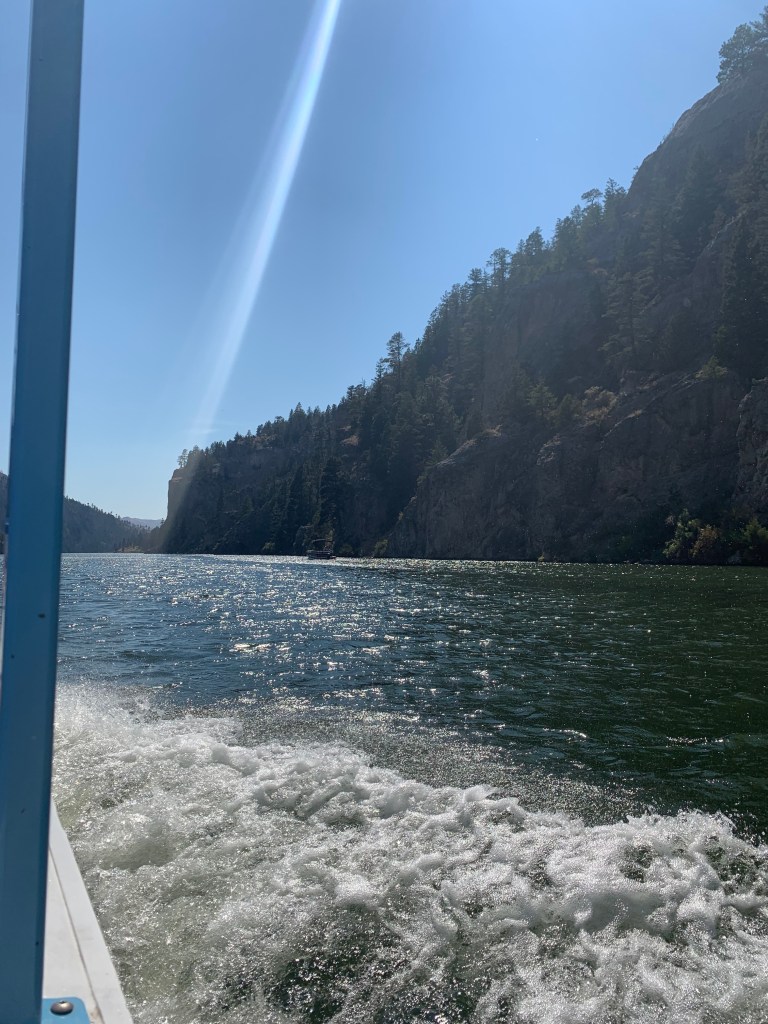
I biked between spires of dark rock, on a leisurely road between the mountains and always right next to the Missouri. My maps had me go along a road that ran parallel to I-15 until just before this point where once again it told me to take the interstate. My mom scouted ahead and said the road continued, so we met where the road ended and we had no other choice but the interstate. Then we called it a day. We went on to Helena to get a campsite at a KOA. On the road and quite on a whim, I saw that there was a “Gateway to the Mountains” boat tour. The last one was at 2pm, so when we had a campsite reserved, we rushed back, and had just enough time to eat lunch before we got on the boat.
From the boat on the Gateway of the Mountains tour
This boat ride was one of the big highlights of this entire trip. I am always excited to get on the water, since I feel visually that’s the closest, I can get to seeing what Lewis and Clark saw. We had a tour guide who knew dozens of stories about the Lewis and Clark Expedition, including directly quoting full entries from their journals. We learned about wildfires in the area, a tragedy at Mann Gulch that is well known amongst wildfire fighters, and about the various sites the founder of the tour pointed out over a hundred years ago that are still there today. Meriwether Lewis named it Gateway to the Mountains in his journals. I left my phone in the car, so I commandeered my mom’s and took an excessive number of photos. I was excited.
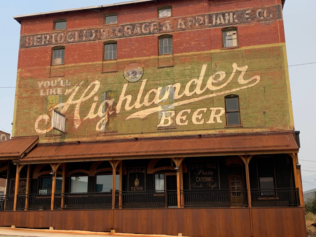
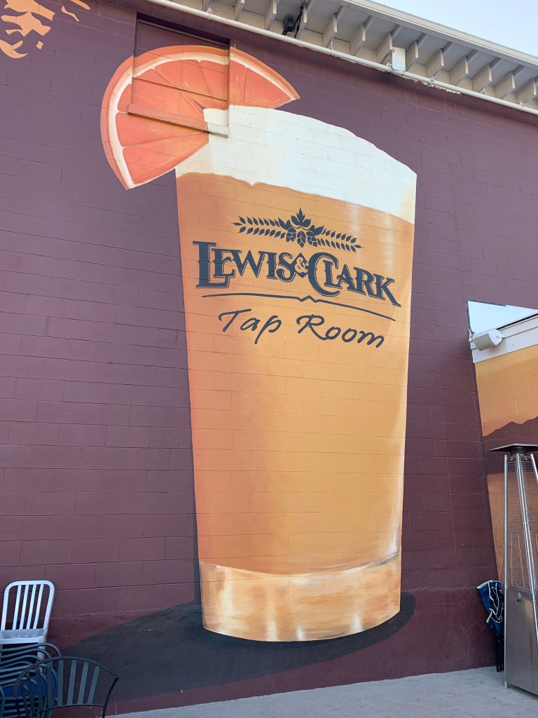
Lewis and Clark Brewing Company!
I discovered as we searched for a place to have dinner, that there was a Lewis and Clark Brewing Company. I’m not really a beer drinker, but I didn’t think I could call myself a Lewis and Clark nerd without going there and trying something. I tried the Prickly Pear Pale Ale because why wouldn’t I with a name like that. My mom had an amber ale. I’m still not a beer person but I didn’t leave without getting myself a Lewis and Clark Brewing Company hat. I would have gotten a t-shirt but none of them were particularly me.
The next day we drove back to Wolf Creek so I could complete my ride to Helena. This was some of the most terrifying riding I’ve done, period. It was a winding mountainous road, but it was all narrow overpass with little to no shoulder. The speed limit was 80mph. At first, I told my mom I wanted her to drive in the right lane slowly with her hazards on so cars would slow down, but the second we got onto the actual interstate I waved my mom along and told her to go on without me. I felt like in trying to keep me safe someone wouldn’t see my mom around a curve, and they’d rear end her. I was practically shaking and to my horror as I went I realized I had my bike light attached to my bike but I had never turned it on!
I finally got to a part with shoulder and biked up yet another endless slope, but when I got to the top the rest of my ride was coasting downhill. I finished early in the afternoon and we visited the Montana History Museum where we saw yet another collection of Charles M. Russell art (they’re seriously obsessed with him in Montana) and then we explored the Capitol Building. There was a little brochure where Seaman the dog was your tour guide. It was adorable.
Our next stretch led us closer to Three Forks, Montana. That’s where the Headwaters of the Missouri are. It was wild to think I was near biking the entirety of the Missouri River. We stopped in Townsend, but drove on ahead to see the Headwaters of the Missouri Museum, yet another adorable local history museum with high school photos from a hundred years ago, Lewis and Clark memorabilia, antiques, vintage and antique clothing, hats, and a room set up to look like a classroom, a dentist’s office and a beauty salon from at least the 1950s. We broke up my ride in an odd way that day. I biked most of my ride toward Three Forks, then we went back to set up our tent at lunch since we were right there, then drove on ahead to visit the museum. On our way back to the campground I had my mom drop me off about 15 miles away from the campground and I biked West to East for the first time. The hills were pretty consistent, so I figured it didn’t make a huge difference which direction I did the mileage in.
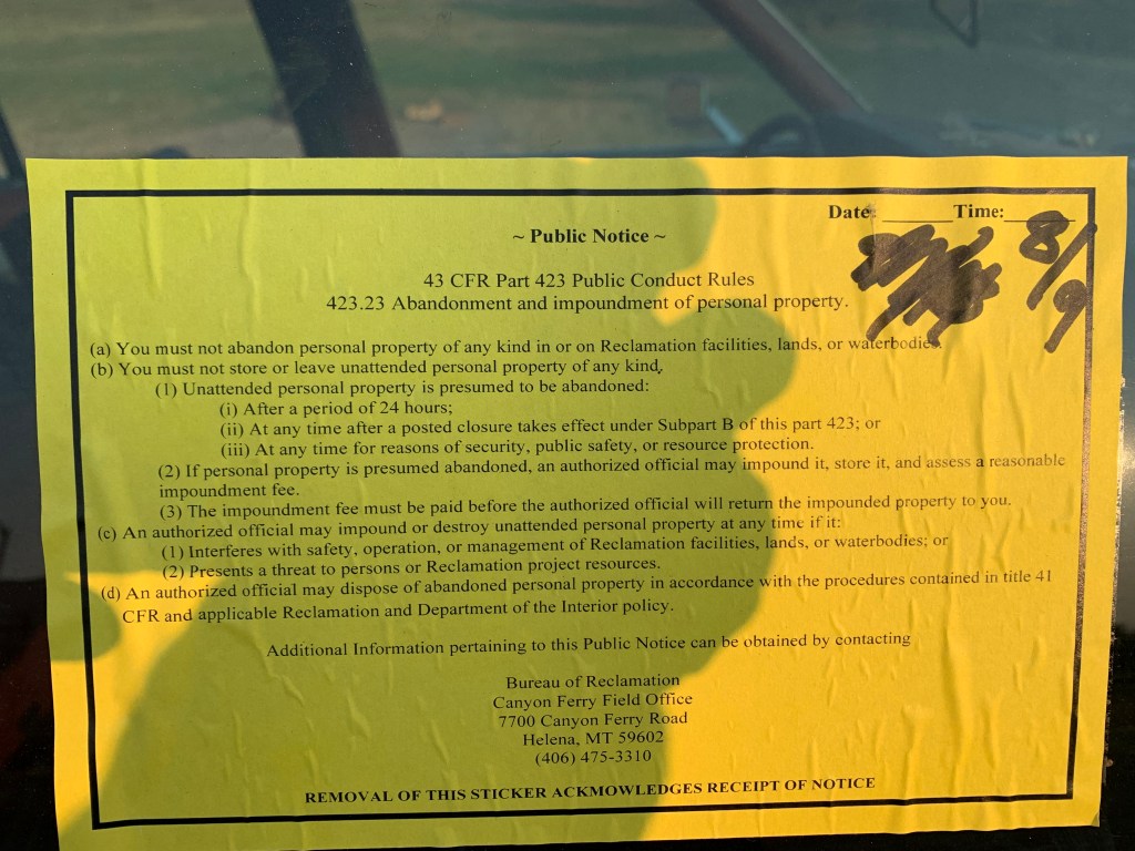
More than of these notices was stuck to an abandoned run-down car at the free bureau of reclamation campsite we stayed at
Our campground was…interesting. There was an old car parked at the site next to us with tickets stuck to it, implying it had been abandoned there for a while. Morbid as we are, my mom and I joked that there was probably a body in the trunk. We read Dracula again and played card games under the picnic shelter when a woman showed up and asked us if it was our car. My mom decided not only to tell her it’s not our car, but to tell her about our morbid theory. She wandered around for a few minutes, then skedaddled. Either we freaked her out or the car did. She was traveling alone with her dog, so I get it. As we continued to play cards someone drove into the day us area, eyed the abandoned car and left. I told my mom I thought that was the murderer.
…Just for fun… guess who i identify with in this photo
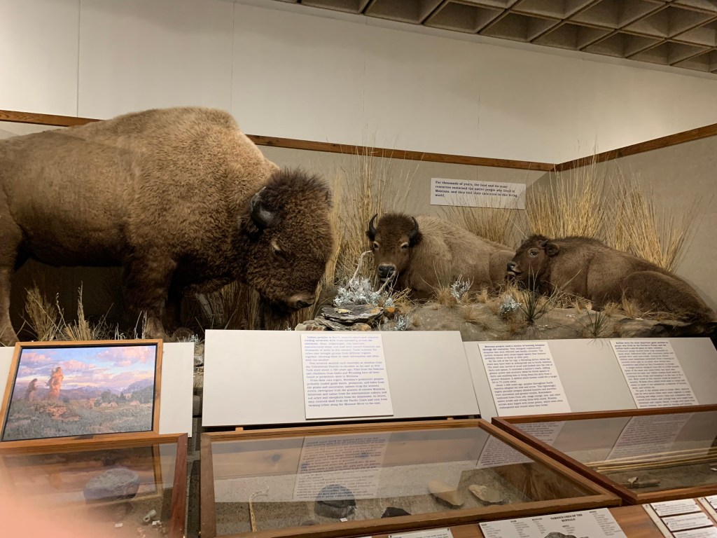
Inside the First People’s Buffalo Jump State Park visitors center
On my way out of Great Falls I had an awful surprise. As I began loading my limited supplies on my bike to head out of town, I couldn’t find my bear mace. We pulled into a parking lot to search. I pulled everything out of the back seat to try to find it, but to no avail. That stuff’s not cheap. As we looked an old man in a pickup truck came to see if we needed help. I told him I couldn’t find my bear spray and he began to lecture me on how I shouldn’t use bear spray and if I see a bear I should just run, preferably downhill. That was the worst advice I have ever heard. Evidently bears, you know, the mountain dwelling beasts, can’t run downhill? I nodded politely and didn’t listen to a word he said. My mom and I went back into the city to a sports store to purchase another can.
From the top of the Buffalo jump!
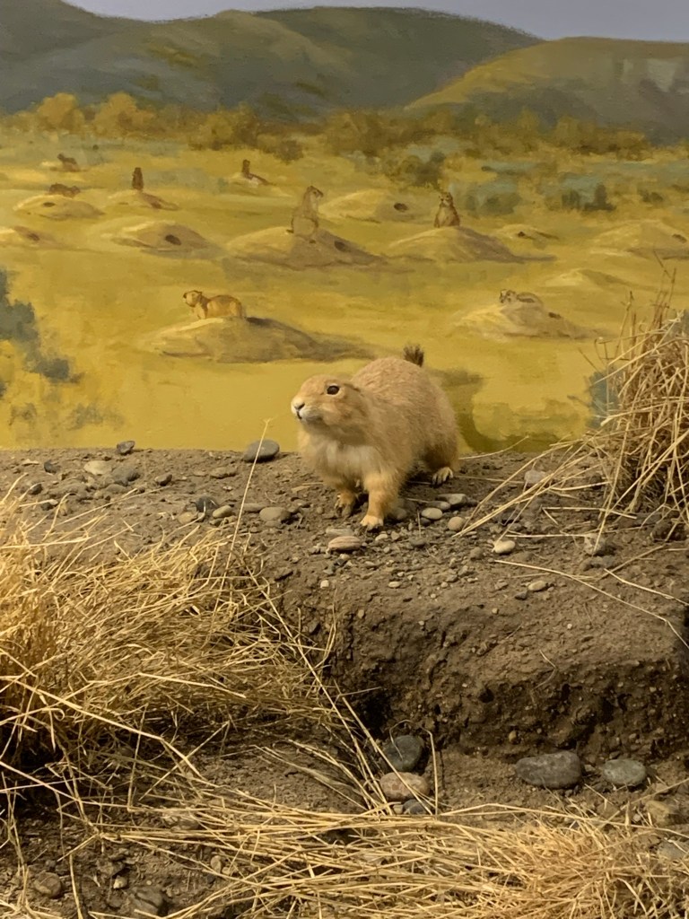
I got a later start that morning than I wanted. It felt like between getting our morning coffee, and the bear mace fiasco, we had gone back and forth past the Lewis and Clark statue we had to scour the earth to find half a dozen times! I was getting impatient to get going. The wind was fierce yet again and I had to fight it for my first ten miles. My mom and I met up for my first break in Ulm. I saw signs on the road for First People’s Buffalo Jump State Park. I convinced my mom to go on a detour and see what was up. There was a small interpretive center and a drive up to the top of the butte and cliff in question. I liked the idea of learning more about the indigenous peoples in Montana. It was a bonus that the top of the buffalo jump happened to be a prairie dog town. First, I heard the squeaking, and I was so convinced that I walked out into the field and suddenly I saw little prairie dog mounds everywhere! Shows how rough my memory is, I completely forgot about this instance, thought my last sighting was in Fort Benton until I started writing this blog post.
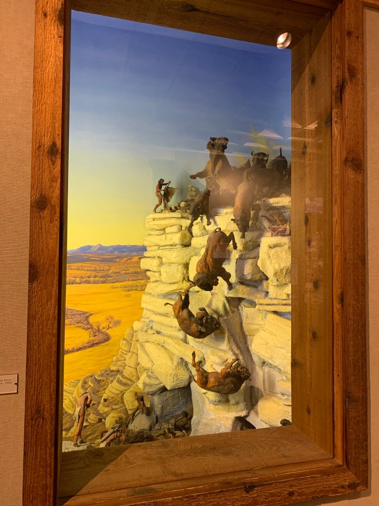
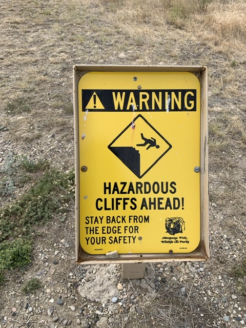
Considering the function of Buffalo jumps, hunting by causing Buffalo to stampede off a cliff and die, it isn’t surprising that the cliffs are hazardous.
It seemed this detour was the right choice. I was wiped when I stopped for this break, and by I got back on the road the wind had calmed and my energy had returned. And thus, I continued down the road and into my first of many ranges of the Rocky Mountains. This range was called the Big Belt Mountains. I followed the Missouri River between them on winding roads. I was itching to see my first sign of the Rockies, and at the time I didn’t realize these were a part of them. Despite this unexpected difficulty I enjoyed every minute biking here. It was sparsely populated, mostly ranches rather than agriculture, a few houses here and there, and beautiful blessed pine trees densely populating the mountainsides. Every few miles there were boat launches and fishing areas, which meant ample spots for my mom to pull off. As I was hyper-vigilant about grizzly bears, when we got to my planned end point and started looking for campsites, there were plenty by the river, just a pull-out with one or two spots. I wasn’t comfortable being close to the river in an area used so much for fishing when there were bears to contend with, so while we probably would have been fine, I found a state park a fair distance up the road.
I spy with my little eye..a prairie dog! On top of the Buffalo jump!
To start with I thought this would be a lovely place to stay. We were on Lake Holter, yet another lake made by damming the Missouri River. The mountains were gorgeous, and green and blue gray. When I got there (I am absolutely sure I’m starting to sound paranoid about bears, but that’s not entirely wrong. My dad has reminded me on a regular basis that I need to be ever vigilant, and he’s gotten in my head) I read the warnings about bear safety. I wanted to talk to the campground host, but no one was in the office. As I filled out the form though, someone drove by in a golf cart and I wound up talking to her. They hadn’t seen a bear there all season, but they were known to have black and brown bears in the area. I talked to her about the man and the bear mace and she agreed with me that he was very wrong. She gave me advice on how to aim it and when I asked if she’d had any practical experience with bears she said that yes, she had had to deploy the bear mace before.
I was smitten with these mountains.
I finished paying. My mom and I chose a spot and set up our tent. I chose an area that had trees I could use my hammock on. After dinner (which we ate at the picnic area to keep food away from our campsite) I got in the hammock and my mom read Dracula aloud until…neighbors showed up.
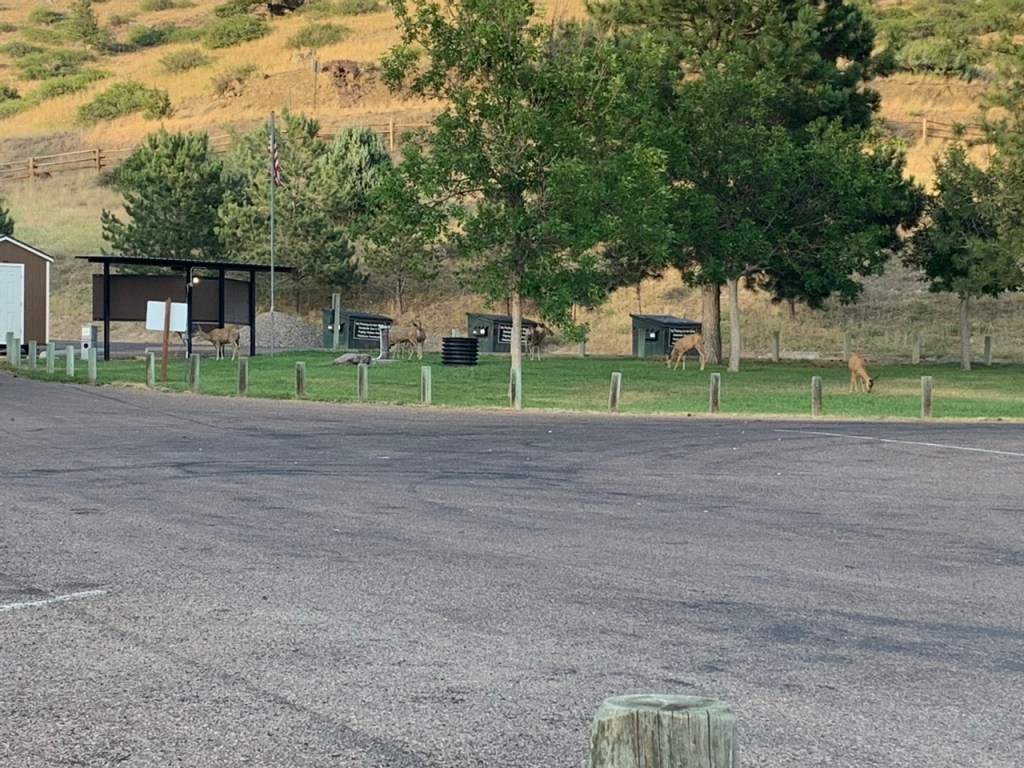
We woke up to se a whole lot of deer wandering our campground.
I don’t understand the inclination to choose a campsite directly next to the only other tent in the tent area. Tent camping is often just a field with trees in it and vaguely numbered sites. While I was in the hammock next to our tent a family with two teenage daughters and a whole lot of angst started setting up their tent within feet of where I was swinging. We put our camp chairs inside of our tent and tried to continue reading. I say tried, because our neighbors were so noisy neither of us could concentrate. We both put ear plugs in and went to bed way before it got dark. When I got up in the morning, I was livid. Not only were our neighbors obnoxiously loud and argumentative, but they left three coolers, a full bag of garbage and a full bowl of dogfood out in the open in bear country. The rules to bear safety are simple. You don’t keep food out where you’re going to camp. You put your garage in the dumpster, you don’t leave it out, you keep all your food and toiletries in a bear cannister, tied up in a tree in a bear bag, or in your car. Bears have an incredible scent of smell. If it smells remotely food-like, they will be attracted to it. All of this, and a woman had been killed by a grizzly bear within the past month very near where we were camping.
I wrote a note listing their mistakes, informing this family that they weren’t just putting themselves in danger, but us as well. I left it on their windshield, as they were still asleep, and left the campground with fury in my veins.
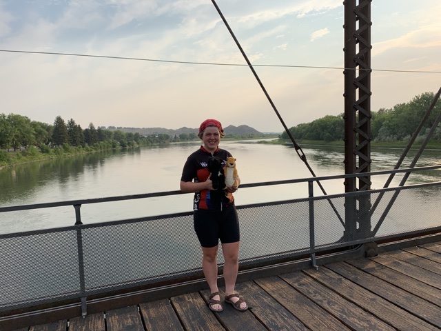
In Fort Benton there’s a footbridge across the river that gives you a gorgeous view of the river. I went for a walk on it with my mom and “the boys” while we had our coffee.
Just outside of Fort Benton I saw my precious prairie dogs for the last time. I was pretty sure I saw the familiar mounds when we drove by after Geraldine, and when I biked past them, I was proven correct. I was so thrilled to see them where I didn’t expect them that it softened the blow, knowing I probably wouldn’t see them again in the wild, at least not for a long time. The ride from Fort Benton to Great Falls was mile after mile of golden grassy hills. Much like Fort Benton, I biked more than halfway there, then backtracked the next day and retraced my steps with pedals. I needed to get to a bike shop. My bike was functioning, but not well. The Lewistown bike shop had only been a temporary solution. At least this time I knew that my bike pretended to behave on the stand, that I needed to test it before I let a mechanic tell me it was fixed.
I got to the bike shop and did my best to explain the problem. I tested my bike and continued to have the same problem. I told the mechanic so and he began explaining to me how to shift gears like I hadn’t biked this bike 4,000 miles to get there. My response came out terser than I intended. “I know how the bike works. I’ve biked it thousands of miles. I rode here from Pittsburgh, Pennsylvania. This is a new problem.” Which got him to test ride it himself. He saw the problem after that. My mom browsed the shop, sat down and waited for a good hour. The mechanic would adjust the bike, think it was working, then test it out and have the same trouble. The owner decided to call in his best mechanic to be sure I’d have a working bike. He had just left when we arrived at the shop. We went out to the car to eat our lunch, and shortly after, we were told the bike was ready. I tested it and it worked! It worked well. Better than it had since Medora! I breathed a heavy sigh of relief.
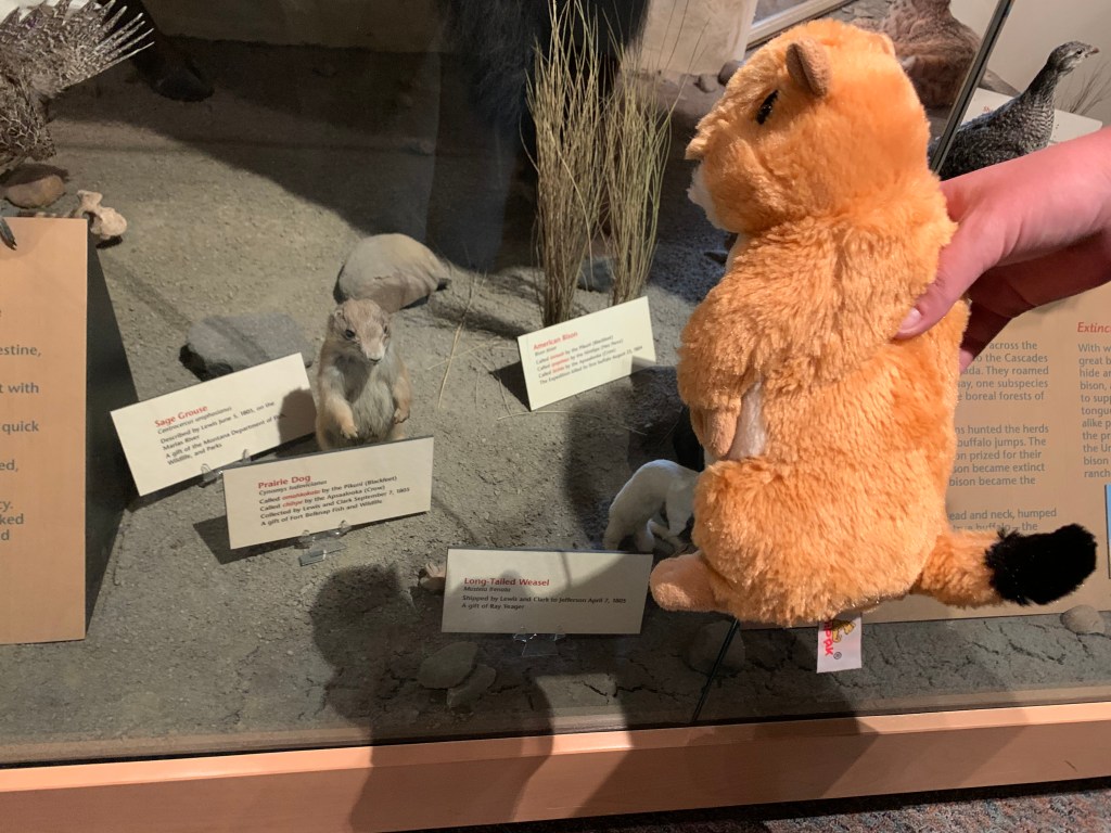
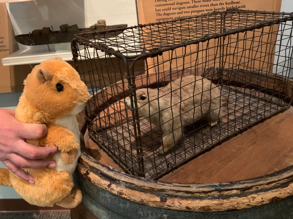
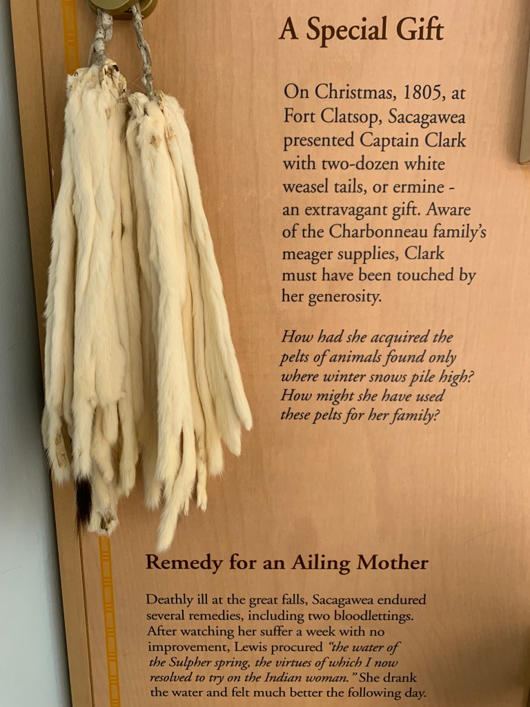
items at the Great Falls Portage Interpretive Center including Pomp with Prairie dogs and a representation of Sacagawea’s Christmas gift to Clark
When that was finally done we went to the Great Falls Interpretive Center to revel in a large Lewis and Clark exhibit—it was basically an entire museum dedicated to them. We stayed for a lecture. I browsed the books in the gift shop as I did every time there was one, chatted with the woman at the register about my bike ride and asked the woman from the front desk about what the best route to take through the mountains was. I had held off on that decision thus far because there were two vastly different routes with pros and cons to each, and the fire was an ever-changing situation. That night I did research on how close campgrounds were and where the fires were, and I assessed the elevation for the second or third time. One route was straight through the mountains west of Great Falls. It was the way Lewis and Clark allegedly returned from the Pacific. It was over 200 miles of steep inclines and drop offs. The other way was almost 500 miles but every single incline was gradual by comparison. My mom told me she’d go which ever way I chose, so while I battled internally for a while over which way was best, I finally decided I wanted to take the route that would let me see the headwaters of the Missouri River, the lands Lewis and Clark encountered the Shoshone and the most difficult mountains of their journey. I chose the longer route.
The next morning after getting a Harry Potter/Ravenclaw themed coffee from a quirky coffee shop, I drove my mom to the other side of the Missouri, through farmlands, into grasslands to a hiking path. We were going to see the Great Falls that I had heard so much about. Way back in Saint Charles I talked to a woman at the Lewis and Clark Boathouse and Museum about the falls. I had read that they were dams now, that the falls weren’t there. She said they were, and that when I got there, I needed to put myself in a position where I heard them before I saw them. So I took my mom on this brief hike on the steep, grassy hillside above the river, along a narrow dirt path lined with prickly pears. Each time we came over the crest of a hill I thought I would see it, but it would be just a bit further. One more crest and I saw it. It was dammed, but you could see the stony falls below a constant stream of water from the dam above.
The old meets the new, I wish all dams would embrace the landscape they were in the way this one does.
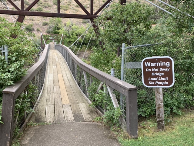
I felt giddy, seeing that sight for the first time, knowing that Lewis had been there two centuries ago. Below us we could see a lush green oasis. There was a picnic area that seemed alien in the wild terrain, but it was beautiful. We headed back to the car and drove down to explore. There was a walking suspension bridge over to an island where we could climb stairs and get a closer view of the rushing water. It creaked as we walked over it. My mom had to take a quick journey outside of herself to get across it. She doesn’t like heights. There was an odd little building with a sign outside of it. Evidently it was built to exhibit the new technology of electric topped stoves. The dam was built in the early 1900s. I wondered when the little building was built. I jokingly told my mom that I was going to get married on this island and force everyone to cross that little bridge to go to the ceremony. I was mostly joking, but it was gorgeous, nonetheless.
The shaky bridge to Ryan Island
After Great Falls we went to the Charles M. Russell Museum. Montana is obsessed with Charles M. Russell. He’s a cowboy artist from the turn of the century and had considerable success in his lifetime. I didn’t even know his work, but I was hoping to see art that might inspire visuals in my head or even directly portray the Lewis and Clark Expedition. I wound up really enjoying the museum. It was huge and a large portion of the collection was by Charles M. Russel, but there was also art by more contemporary artists, and even a Warhol exhibit we weren’t allowed to take pictures of. It was pouring when we got outside. I hadn’t planned to visit the cabin his studio was in or the house museum next door, but I was not dressed for rain, so I hopped from one building to the next to explore on the way back to our car.
some cowboy art from the Charles M Russell Museum
The rain calmed not long after, so quickly I forgot about it, sometime after my second coffee of the day. I love museums, but they are so much mental stimulation that I always wind up ready for a nap while I’m there. After that we returned to the Lewis and Clark Interpretive Center where there was a long paved bike path along the river. I had seen what looked like a statue of Lewis and Clark from the road the day before. When I investigated it, I found that I was right. We went on a long walk to try to find it, but when we got there, the image on Google Maps did not match the sculpture we saw. This was a sculpture of Lewis, Clark and Sacagawea that looked like it was made of scrap metal. I returned to the visitor center where we parked and asked one of the NPS employees if he knew where the sculpture was. It took some deduction, but he eventually gave me vague directions. My mom and I went on quite the adventure trying to find it. We walked for miles around a horseshoe shaped park before I decided to take another look in my phone. There was yet another park! There was a statue of Lewis, Clark, York and Seaman high on a hillside overlooking Great Falls. Having finally found the statue I was content. The next morning we left Great Falls southward toward the Headwaters of the Missouri River and into the mountains.
You might be asking yourself, “Meghan, why so resistant? Just go to the bike shop!” I was in Montana. There were vast spaces between towns. It was over 100 miles to Lewistown. I had to wrestle with skipping such a huge chunk of mileage. I wanted to backtrack when I got my bike working again, but we were getting so close to Great Falls! I was pretty upset even at the idea of driving it, and more upset when I actually had to give in. I told my mom she needed to give me an ultimatum, tell me we were going to Lewistown, because I’d keep trying to fix my bike until my brain exploded. I reminded myself of two things when I submitted. First, Lewis and Clark never went along the route I was biking. The sooner I skipped, the sooner I would return to the Missouri River, and second, Over the course of the last few thousand miles, particularly the 3 thousand I’d ridden before I had a support vehicle, I had added a lot of miles to my trip. I biked off the route searching for campgrounds or hotel, and second, I went to every single Lewis and Clark site, and everything tangentially related I could. That added a lot of mileage. I needed to let myself be more flexible. I’ve always been upfront about how much of a completionist I am. It’s the first thing I say to people when I tell them I started in Pittsburgh, not Saint Louis. I read A Walk in the Woods at my friend Becca’s recommendation as preparation for my trip. If Bill Bryson can write a book about hiking the Appalachian Trail when he only hiked maybe half of it, I don’t have to be so hard on myself for having to skip a hundred miles when I had no other option.
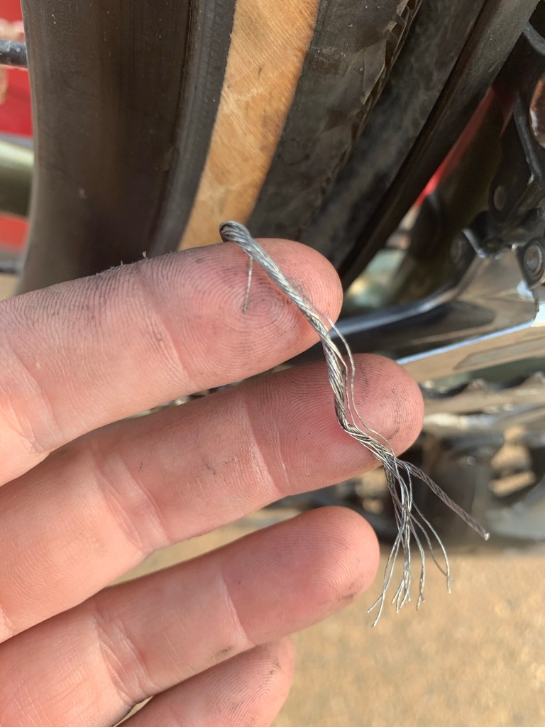
I didn’t have the right tools to work with the cable, but I kept on trying until the cables frayed. That was the point of no return. I needed them to be replaced before I could get biking again.
We left Jordan mid-morning after a grabbing a coffee in town. I was emotionally exhausted, so while my mom drove, I slept, even though I wanted to see the scenery change. It did change. It went from dry grass, and crispy hills to scattered pine trees and small mountains. We went straight to the bike shop. It was legitimate enough to be listed on my official Adventure Cycling Association map, but it was tucked into a residential neighborhood. My GPS led me to someone’s private home. We saw a woman emerge from the house and head for her van, but we didn’t react quickly enough to flag her down. She noticed us though! She turned around the corner and pulled up to our car. She saw my bike on the back. Turns out she was engaged to the bike mechanic, and they were getting married that weekend! We were there before the shop opened. He worked as a physical science teacher during the day. He ran his bike shop out of the shed in his yard. She said he’d be happy to help me and called him.
He came down and I explained my trouble to him. My mom and I grabbed lunch at a brewery in town. By mid-afternoon he called me and said my bike was ready. I was so relieved I took the bike and left, assuming the problem was fixed, I didn’t test it out. I needed to get to a coffeeshop and work on my blog. I knew I had to test it before I got back on the road though, so a few hours later, I hopped on my bike and my heart sank. It still wasn’t shifting. I called the mechanic and race back to the shop before he was meant to close. It was the same trouble I’d had when I tried to fix it myself. It worked on the stand, but the moment I tested it out, it didn’t work. I tested it three different times. He kept on adjusting it and then finally he tested it out himself. I know he was frustrated, I was frustrated, but he was polite and eternally patient. I waited outside the shop with my mom, trying to keep the mood light. The collar that attached my derailleur to my bike had a strip of rubber adhered to it that was meant to keep the derailleur from sliding down without biting into the metal. Because of the heat I’d been biking in, the adhesive had melted, so the derailleur kept slipping down.
This is where the derailleur attaches to the bike. See what I mean? It kept slipping down!
I mentioned that little piece of rubber to my dad on the phone. It seemed like no matter what I did trying to move the derailleur, the derailleur wouldn’t sit on that piece of rubber. I thought it was my own failure, that I just couldn’t get the right angle, or didn’t have enough strength to tighten it where it would say. I felt vindicated that this man who obviously knew what he was doing far more than I did, had the same experience. I called my dad to tell him the answer to the conundrum, that the bike mechanic told me I should go to a bigger bike shop in Great Falls and see if they had a permanent solution to the problem. My dad suggested I get a hose clamp to prevent the slipping problem temporarily. I still had the hose clamps that held my bike rack on in those nerve-racking days before I had a support vehicle, so I used that. It solved the problem well enough, because I eventually made it to Great Falls.
Evidently Montana doesn’t know what a taco looks like. The menu at Taco Time was 99% burritos and one quesadilla. They called tater tots “Mexican fries”
We stopped at a sports store in Lewistown. My mom was done sleeping in the car and I didn’t blame her. Her friend Jean (the same Jean who joined my mom on her drive to meet up with me) suggested that we get another tent, but my mom was concerned about how much time it would take to set up and take down two tents. I suggested we get one tent that would fit both of us. That night we ate dinner at the Taco Time across the street. There was not a single actual taco on their menu.
Left, my first sight of mountains and right, it’s. Butte! Square Butte maybe?
From Lewiston I biked to Geraldine, Montana, a town approximately a block long. That was the first day I felt the need to bring my bear mace with me for the first time ever. I was biking through the Juliet Mountains, for the river William Clark named after his future wife. I was getting close to the Missouri again! I had experienced smoke North Dakota, but this was the first time I felt the need to cover my face with my neck gator while I biked. I knew we were close to fires. In Jordan we booked a room in a motel that was brimming with wildfire fighters. We were told it was close to town, but it hadn’t been problematic. The same thing had happened in Lewistown. You could even donate a drink to thank a firefighter at the brewery.
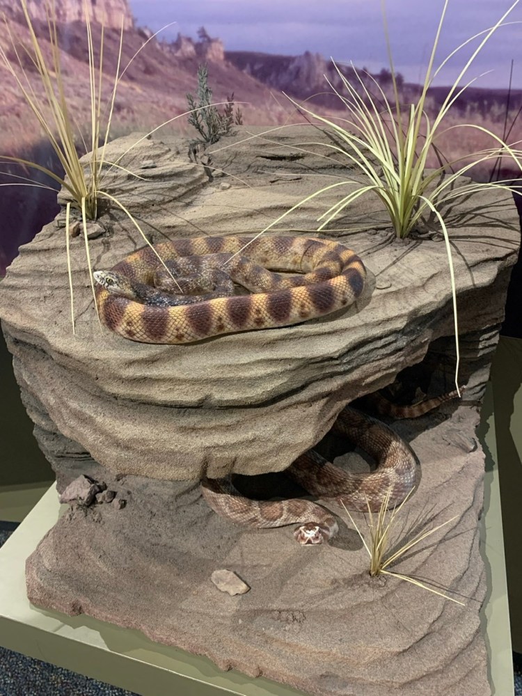
I didn’t doubt there were fires, but I hadn’t seen the evidence of them myself, only the hint, but I was having trouble breathing while cycling. It was hot, and it was hard to tell which was worse, wearing a mask while biking and stifling in the heat to save my lungs from particulates, or not wearing a mask, free from the heat of my gator but choking on particles of ash. It wasn’t obvious, but the smoke was affecting visibility. It got more obvious. As I biked down the road I saw a long object that stretched across the shoulder and more than half way across my lane of traffic. I thought it was debris until I got within 15 feet of it. Then I realized it was a rattlesnake. The recognition clicked, then the realization that this thing was HUGE. I shouted to no one, “That’s a snake! That’s a big snake!” The snake was facing toward the double yellow lines, so I made a split second decision. I pedaled hard and rolled into the crispy golden grass on the side of the highway. The snake saw me, started rattling its tail and lunged, but it had to propel itself from the double yellow line across the entire lane of traffic, across the shoulder to even get close to me. It didn’t even make it the length of its own body, and I just kept trucking, swearing profusely. That was a narrow escape.
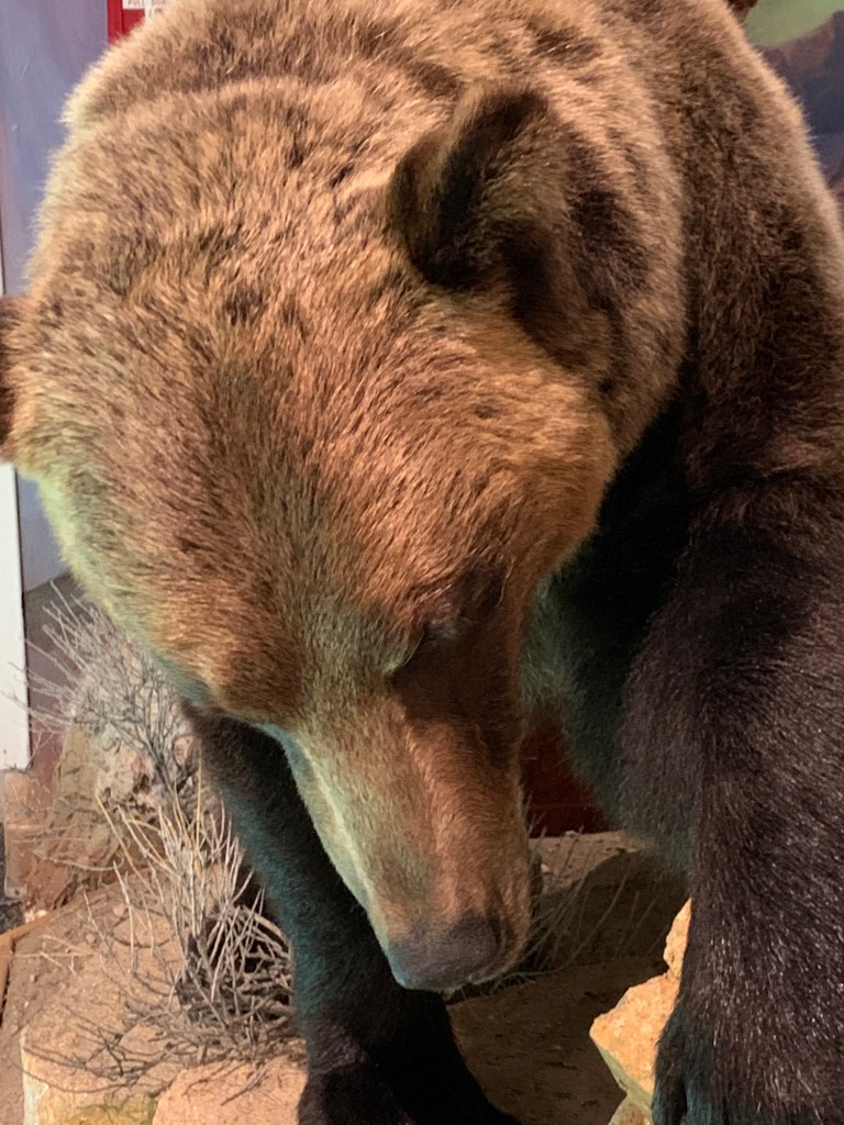
A rattlesnake and bull snake at the Upper Missouri Interpretive Center
We had lunch in Denton, a longer break than we intended, but the restaurant was surprisingly busy. A group of strangers asked me about my bike trip, the waitress seemed pretty interested as well, so we chatted for a while. I saw the same people again in Fort Benton. I think they were going on a canoeing or kayaking trip together down the Missouri River.
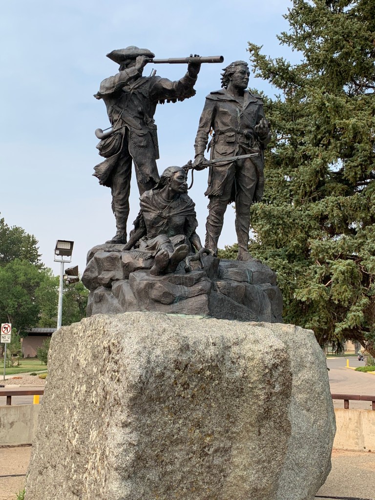
Fort Benton! Lewis, Clark and Sacagawea next to… well, Lewis and Clark?
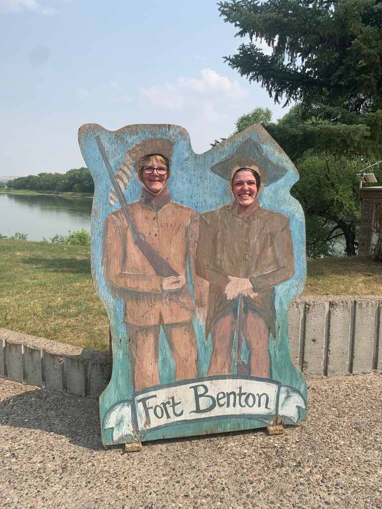
There wasn’t much in the way of campgrounds on that stretch, though it was safe to say we didn’t look particularly hard. We had the luxury of being able to drive to an alternative, so I suggested we go to Fort Benton. There were a number of museums I wanted to visit in town and it was the most populated city before Great Falls. We got there just before the museums closed and decided to hold off til the next day to explore, but we grabbed ice cream, took a picture of their Lewis and Clark statue and went to set up our tent. As we explored downtown briefly my mom noticed by sheer coincidence that Montana Shakespeare in the Parks was in town that night! So we hung out at our campground, chatted for a bit with our neighbor who was about go on a multiple day canoe trip down the Missouri, and headed to the park. It was a Midsummer Night’s Dream. We stayed for the beginning, camp chairs out, but I was hungry, and the turn-out was so good that the one food truck had run out of absolutely everything. We decided to depart and find a meal elsewhere.
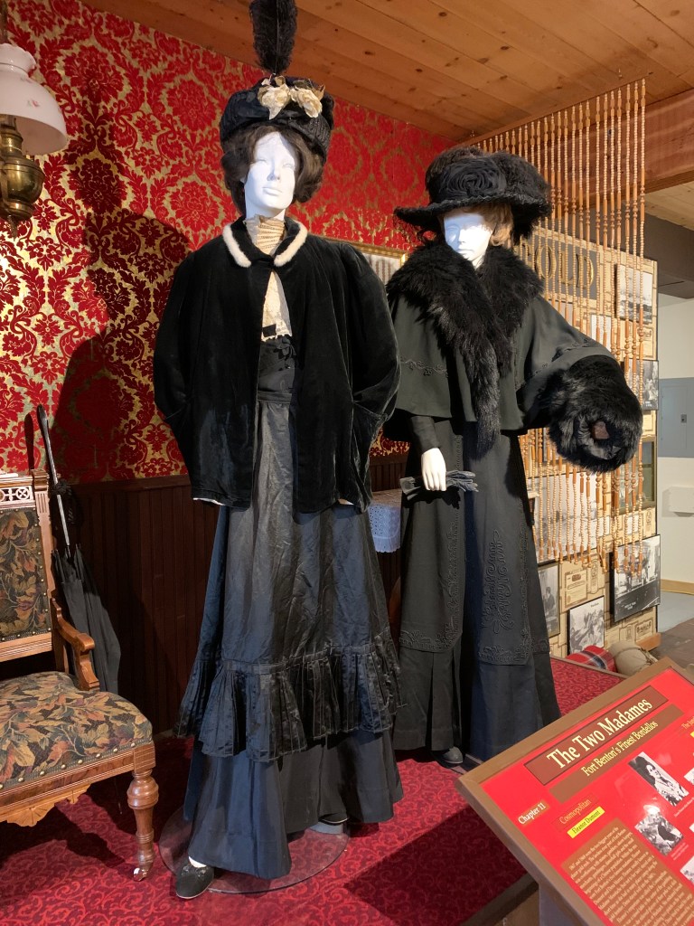
Some pictures from the museums we visited
My mom wasn’t particularly hungry, or particularly excited about spending money on a big meal, so I suggested we go somewhere to split an appetizer. We went to the Golden Triangle Brewery. Once again, we experienced magical timing. The brewery was a few questions into their trivia night but guess who won that trivia night. It was us. We won! I let a local about my age take a pic with the coveted belt, because her friends bailed on her and she wound up jumping in with another team.
Victory! My mom and I with the trivia championship belt!
We got back to the campground and I chatted with another man who was there to paddle the Missouri. He was a campground host somewhere in Montana, and I asked him for advice about camping in bear country. He said leaving your food in your car was the main thing, and sleeping with bear mace nearby. The fact that we got the tent and would keep our food away from it was the right idea. I felt slightly less paranoid.
The cliffs right by our campground on the Missouri River and right next to the rodeo/fairgrounds
The next day I backtracked to Geraldine and biked all the way to Fort Benton. I biked until lunchtime, we headed into the city to see the museums. I was worried about getting back when they closed again. There was an Upper Missouri interpretive center, and the Fort Benton Museum complex which included a Northern Great Plains Museum and the 19th Century fort. I was glad we went to the effort to see both. I pointed out an error on one of the signs in the museum, a sentence that implied Meriwether Lewis was in two places at once.